PAGASA: Enteng to strengthen into tropical storm; 17 areas under Signal 1

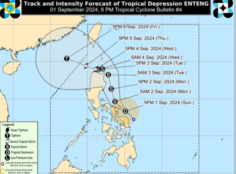
Tropical Depression Enteng was expected to strengthen into a tropical storm within the next 12 hours, PAGASA said on Sunday evening.
The state weather bureau also said that Enteng was likely to "make landfall or pass very close to Catanduanes" within the next three hours.
Tropical Cyclone Wind Signal No. 1 was raised over 17 areas:
Luzon
- The eastern portion of Cagayan (Lal-Lo, Gattaran, Buguey, Santa Teresita, Gonzaga, Santa Ana, Baggao, Peñablanca)
- The eastern portion of Isabela (Palanan, Dinapigue, Divilacan, San Agustin, San Guillermo, Jones, Echague, San Mariano, Maconacon, San Pablo, Cabagan, Tumauini, Ilagan City)
- The southern portion of Quirino (Nagtipunan, Maddela)
- The southern portion of Nueva Vizcaya (Alfonso Castaneda)
- Aurora
- Northern and southern portion of Quezon (Tagkawayan, Guinayangan, Buenavista, San Narciso, Mulanay, San Andres, San Francisco, Lopez, Calauag, Catanauan, Gumaca, Macalelon, General Luna, Quezon, Alabat, Perez, General Nakar, Infanta, Real, Mauban, Unisan, Pitogo, Padre Burgos, Atimonan, Agdangan, Plaridel) including Polillo Islands
- Camarines Norte
- Camarines Sur
- Catanduanes
- Albay
- Sorsogon
- Masbate including Ticao and Burias Islands
Visayas
- Northern Samar
- Samar
- Eastern Samar
- Biliran
- The northeastern portion of Leyte (Babatngon, San Miguel, Tacloban City, Alangalang, Santa Fe, Palo, Barugo)
Enteng's was located over the coastal waters of Baras, Catanduanes, and was moving northwestward at 15 km/h.
It had 55 km/h sustained winds and gustiness of up to 70 km/h.
PAGASA noted that the highest possible Wind Signal that may be hoisted during the passage of Enteng was Wind Signal No. 2 or 3.
Enteng was forecast to move generally northwestward to west-northwestward until Monday.
It will make landfall over Catanduanes within the next there hours, and the mainland Bicol Region within the next 12 hours. — DVM, GMA Integrated News


