

Filtered by: Scitech
SciTech
Signal No. 1 up over 16 areas; Enteng to make landfall within 24 hours
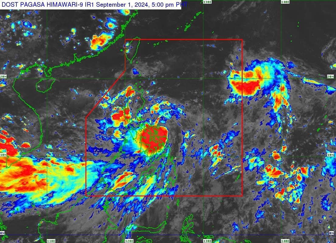
Tropical Cyclone Wind Signal No. 1 was raised over 16 areas on Sunday as Tropical Depression Enteng slightly intensified, according to PAGASA's 5 p.m. weather bulletin.
The state weather bureau said the areas under TCWS No. 1 are:
Luzon
- The southeastern portion of Cagayan (Baggao, Peñablanca)
- The eastern portion of Isabela (Palanan, Dinapigue, Divilacan, San Agustin, San Guillermo, Jones, Echague, San Mariano, Maconacon, San Pablo, Cabagan, Tumauini, Ilagan City), the southern portion of Quirino (Nagtipunan, Maddela)
- The northern portion of Aurora (Dilasag, Casiguran, Dinalungan, Dipaculao, Baler)
- Polillo Islands
- The southern portion of mainland Quezon (Tagkawayan, Guinayangan, Buenavista, San Narciso, Mulanay, San Andres, San Francisco, Lopez, Calauag, Catanauan, Gumaca, Macalelon, General Luna, Quezon, Alabat, Perez)
- Camarines Norte
- Camarines Sur
- Catanduanes
- Albay
- Sorsogon
- Masbate including Ticao and Burias Islands
Visayas
- Northern Samar
- Samar
- Eastern Samar
- Biliran
- The northeastern portion of Leyte (Babatngon, San Miguel, Tacloban City, Alangalang, Santa Fe, Palo, Barugo)
In its forecast, PAGASA said Enteng will move generally northwestward until early morning of Monday, September 2, and it may make landfall in the vicinity of Catanduanes or Albay in the next 12 hours.
"Enteng will turn more north northwestward or northward after emerging over the waters north of Camarines Provinces and move over the waters east of Luzon," the state weather bureau said.PAGASA said Enteng is expected to reach tropical storm category within the next 12 hours, and it is likely to remain at this category until early Wednesday.
"It may also reach a peak category of typhoon by Thursday or Friday," it said.
As of 4 p.m. today, the center of Enteng was estimated at 100 km Northeast of Catarman, Northern Samar or 115 km East Southeast of Virac, Catanduanes (13.0°N, 125.5°E).
It has maximum sustained winds of 55 km/h near the center, gustiness of up to 70 km/h, and central pressure of 1000 hPa, moving Northwestward at 15 km/h.
It said strong winds may extend outwards up to 200 km from the center.
"Forecast rainfall is generally higher in elevated or mountainous areas. Under these conditions, flooding and rain-induced landslides are likely especially in areas that are highly or very highly susceptible to these hazards as identified in official hazard maps and in localities that experienced considerable amounts of rainfall for the past several days," PAGASA said.
It also noted that the enhanced Southwest Monsoon or Habagat will bring moderate to intense rainfall in other areas of Luzon and Visayas (especially along the western portions).
The highest possible Wind Signal that may be hoisted during the passage of ENTENG is Wind Signal No. 2 or 3, the weather bureau warned.—Sherylin Untalan/RF, GMA Integrated News
Find out your candidates' profile
Find the latest news
Find out individual candidate platforms
Choose your candidates and print out your selection.
Voter Demographics
