Batanes under Signal No. 1 as Carina heads for China

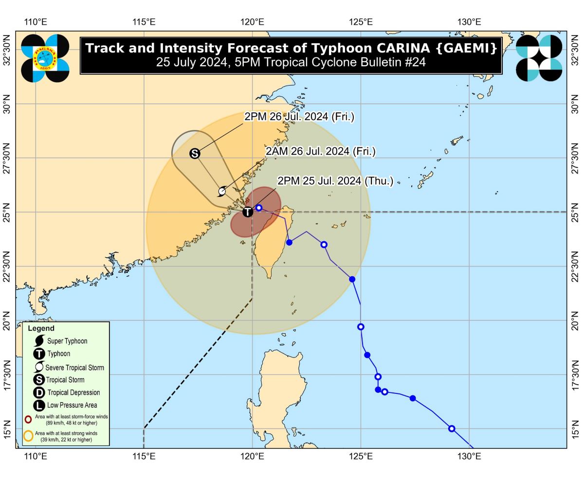
Batanes remains under Signal No. 1 as Typhoon Carina moves further away from the country.
As of 4 p.m. Thursday, Carina was spotted 550 km north northwest of Itbayat, Batanes.
Moving west southwestward at 10 km/h, Carina carries maximum sustained winds of 120 km/h near the center and gustiness of up to 180 km/h.
PAGASA exited the Philippine Area of Responsibility on Thursday morning. It then hit Taiwan before heading to southeastern China.
''Typhoon Carina is now less likely to directly bring heavy rainfall over any portion of the country,'' PAGASA said in its 5 p.m. bulletin.
''However, the Southwest Monsoon enhanced by Carina will bring heavy to intense rainfall over Ilocos Region, Abra, Apayao, Benguet, Zambales, and Bataan for tonight, while moderate to heavy rainfall over various localities in the western portion of Luzon [will occur] from tonight through Saturday.''
Meanwhile, PAGASA is keeping an eye on a low pressure area.
At 3 p.m., the LPA was located 985 kilometers east of southeastern Mindanao, according to PAGASA's 24-hour weather forecast issued at 4 p.m. Thursday.
The weather disturbance has yet to affect any part of the country. —VBL, GMA Integrated News


