

Carina to continue enhancing Habagat; Signal No. 2 up in Batanes
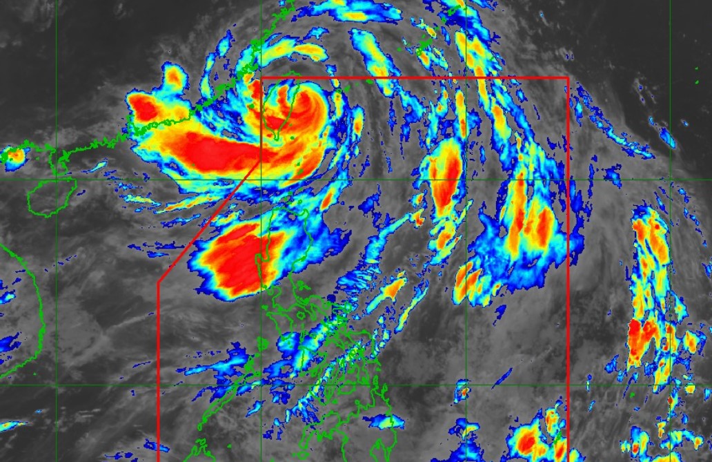
Tropical cyclone Carina will continue to enhance the Habagat (Southwest Monsoon) and bring moderate to intense rainfall over the western portion of Luzon until Saturday, the weather bureau PAGASA said on Wednesday night.
According to PAGASA's tropical cyclone bulletin at 11 p.m., Carina is forecast to make landfall in Taiwan between Wednesday night and Thursday morning before exiting the Philippine Area of Responsibility (PAR).
Carina has been downgraded from super typhoon to typhoon but Batanes remains under Signal No.2 and may expect gale-force winds of 62 to 88 kph over the next 24 hours.
Typhoon Carina was last seen moving southwestward at 15 kph at 335 kilometers north of Itbayat, Batanes at 15 kph.
It had maximum sustained winds of 175 kph, gustiness of up to 215 kph, a central pressure of 930 hpA, and strong to typhoon-force winds extending outwards up to 700 kilometers from the center.
Minor to moderate threat to life and property may occur in affected areas.
The following areas under Signal No. 1 may experience strong winds of 39 to 61 kph over the next 36 hours:
- Babuyan Islands
- The northern portion of mainland Cagayan (Claveria, Santa Praxedes, Sanchez-Mira, Pamplona, Abulug, Ballesteros, Aparri, Camalaniugan, Buguey, Santa Teresita, Santa Ana, Gonzaga)
- The northern portion of Ilocos Norte (Burgos, Bangui, Pagudpud, Dumalneg, Adams)
—NB, GMA Integrated News
