

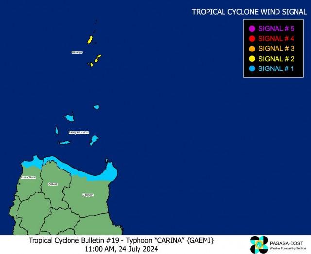
Carina continues to intensify; Signal no. 2 up in Batanes
Batanes remains under storm signal number 2 as typhoon Carina continues to intensify while moving towards Taiwan, according to state weather bureau PAGASA.
These are the latest Tropical Cyclone Wind Signals (TCWS) based on PAGASA's 11 a.m. bulletin:
TCWS No. 2
- Batanes
TCWS No. 1
- Babuyan Islands
- The northern portion of mainland Cagayan (Claveria, Santa Praxedes, Sanchez-Mira, Pamplona, Abulug, Ballesteros, Aparri, Camalaniugan, Buguey, Santa Teresita, Santa Ana, Gonzaga),
- The northern portion of Ilocos Norte (Burgos, Bangui, Pagudpud, Dumalneg, Adams)
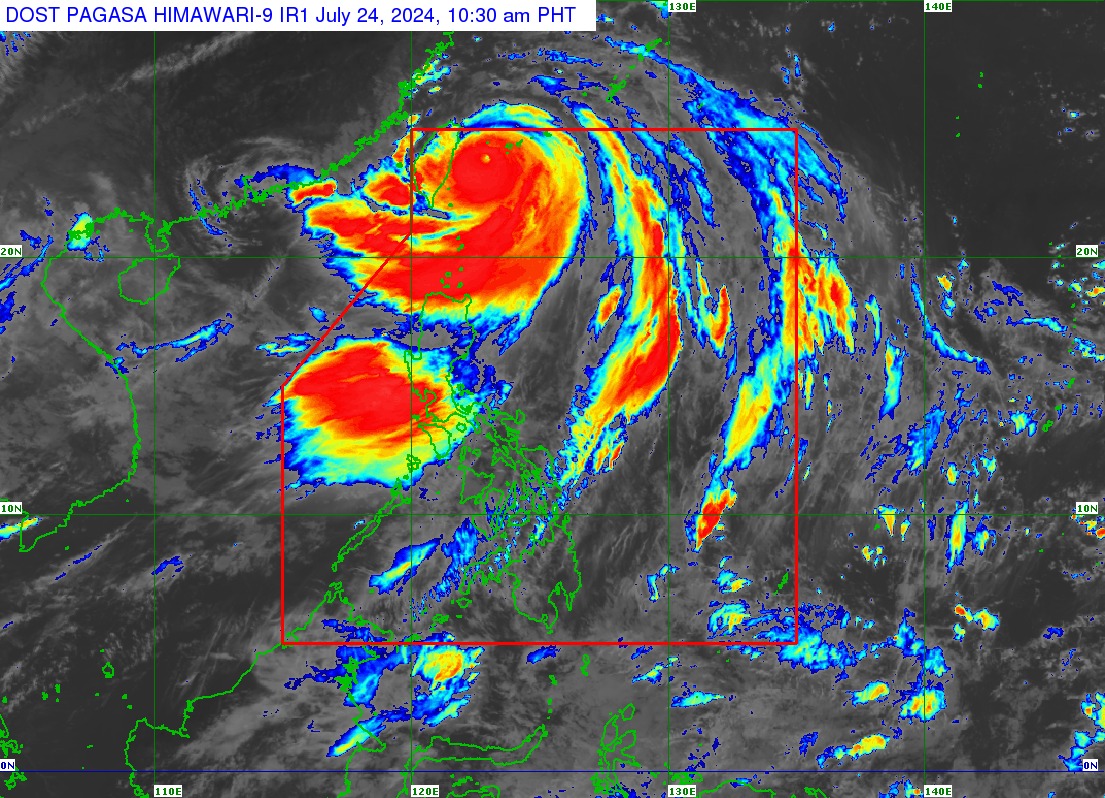
The center of the eye of the tropical cyclone was last seen 345 kilometers north northeast of Itbayat, Batanes. It is moving north northwestward at 15 kph while packing maximum sustained winds of 165 kph near the center, gustiness of up to 205 kph, and a central pressure of 940 hPa.
Heavy rainfall
Meanwhile, an accumulated rainfall of 50-100 milimeters are expected over Batanes and Babuyan Islands on Wednesday to Thursday, July 25.
“Under these conditions, flooding and rain-induced landslides are possible especially in areas that are highly or very highly susceptible to these hazards as identified in official hazard maps and in localities that experienced considerable amounts of rainfall for the past several days,” said PAGASA.
The weather bureau added the Habagat enhanced by Carina will bring moderate to intense rainfall across western Luzon from Wednesday to Friday.
Severe winds
Meanwhile, the weather bureau raised the possibility of hoisting storm signal number 5 in extreme northern Luzon due to severe winds.
The enhanced Southwest Monsoon will likewise continue to bring gusty conditions over the following areas not under any storm signal, especially in coastal and upland/mountainous areas exposed to winds: Aurora, Bataan, Bulacan, Metro Manila, Calabarzon, Mimaropa, Bicol Region, Visayas, Dinagat Islands, Camiguin, and most of Zamboanga Peninsula.
Marine gale warning
A marine gale warning will also remain in effect over the coastal waters of Batanes, Babuyan Islands, and the northern portion of Ilocos Norte and Cagayan.
“Sea travel is risky for small seacrafts, including all types of motorbancas,” said PAGASA.
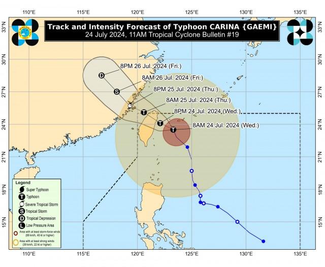
Forecast track
Carina is seen to cross the rugged terrain of Taiwan and exit the Philippine Area of Responsibility (PAR) on Thursday morning.
It is expected to steadily intensify and may reach its peak intensity before making landfall over the northern portion of Taiwan on Wednesday evening or Thursday morning.
Red rainfall warning
A red heavy rainfall warning was raised over six areas in Luzon on Wednesday due to the Southwest Monsoon or Habagat
In its Heavy Rainfall Warning issued at 11 a.m., PAGASA said a red warning level was hoisted in Metro Manila, Rizal, Bataan, Bulacan, Pampanga, and Zambales.
Several areas in Metro Manila were already flooded early Wednesday as some roads were not passable while several residents struggled with the rising water.
Forced evacuations were also implemented in Marikina as the river reached third alarm.
Parts of NLEX were also hit by floods rendering some motorists stuck in heavy traffic.
Casualties
Four people, including a pregnant woman, were killed in a landslide incident in Agoncillo, Batangas amid the inclement weather in many parts of Luzon, the local government said Wednesday.
The bodies of the four victims have all been recovered.
The landslide, the local government said, took place in Sitio Manalo in Barangay Subic Ilaya.
—VAL, GMA Integrated News
