

Carina maintains strength as it moves northwest
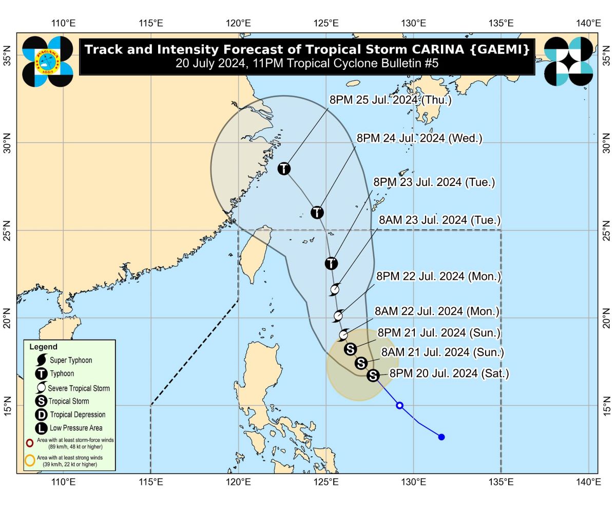
Tropical Storm Carina has maintained its strength as it slightly accelerated northwestward, PAGASA said in its 11 p.m. Saturday bulletin.
Moving northwestward at 20 km/h, Carina was last spotted 545 kilometers east of Casiguran, Aurora, carrying maximum sustained winds of 65 km/h and gustiness of up to 80 km/h.
There were no tropical cyclone wind signals yet, but PAGASA said it was not ruling out the possibility of hoisting Signal No. 1 over Extreme Northern Luzon and the northeastern portion of mainland Cagayan.
The storm is anticipated to bring heavy rainfall to parts of Luzon over the next three days.
Sunday evening to Monday evening
500 to 100 mm: The northeastern portion of mainland Cagayan and the eastern portion of the Babuyan Islands
Monday evening to Tuesday evening
50 to 100 mm: Batanes and Babuyan Islands
The enhanced Southwest Monsoon caused by Carina and former Tropical Depression Butchoy outside the Philippine Area of Responsibility (PAR) may also cause moderate seas over the northern seaboard of Northern Luzon, the western seaboards of Central and Southern Luzon, and the eastern seaboard of the Philippines, as well as strong to gale-force gusts in several parts of the country over the next few days:
- Sunday: Kalayaan Islands
- Monday: Zambales, Bataan, Metro Manila, CALABARZON, MIMAROPA, Bicol Region, Western Visayas
- Tuesday: Ilocos Region, Zambales, Bataan, Aurora, Metro Manila, CALABARZON, MIMAROPA, Bicol Region, and Western Visayas.
Even though it is predicted that Carina will stay far from the Philippine mainland, it might strengthen into a severe tropical storm by Monday and then, on Tuesday, become a typhoon.
It is expected to exit the PAR by Wednesday. — VBL, GMA Integrated News
