

PAGASA: Aghon exits PAR, leaves N. Luzon with moderate to heavy rain
Typhoon Aghon has officially exited the Philippine Area of Responsibility, according to PAGASA on Wednesday.
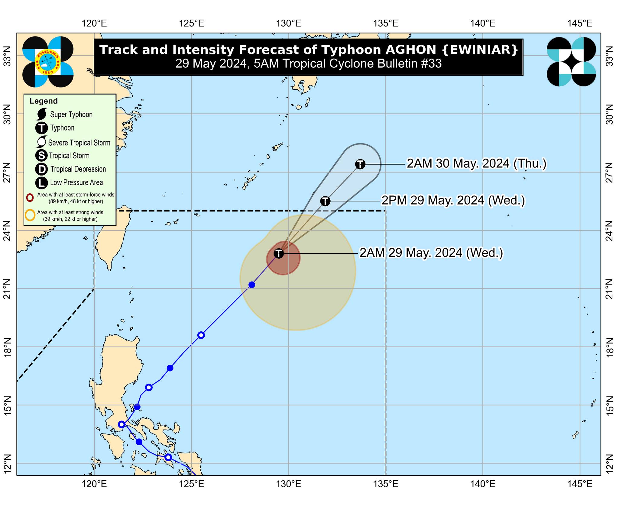
On a dzBB report by Glen Juego on Wednesday, the state weather bureau said that the typhoon exited the PAR at around 12 noon.
In its 11 a.m. cyclone bulletin, PAGASA noted that the cyclone was moving with speeds of 35 kph at 1,060 kilometers east northeast of Extreme Northern Luzon.
The center of the eye was estimated 1,255 km East Northeast of Extreme Northern Luzon.
The typhoon had maximum sustained winds of 120 kph and gustiness of up to 150 kph.
Aghon has partly influenced the Southwesterly Windflow and will bring moderate to heavy rains over the western portions of Northern Luzon, Central Luzon and MIMAROPA until Thursday, as well as gusty conditions in the following areas within the next three days:
- Wednesday: Batanes, Ilocos Region, Zambales, Bataan, northern Aurora, southern mainland Quezon, Polillo Islands, Palawan, Lubang Islands, Romblon, Marinduque, and Camarines Norte
- Thursday: Batanes, Ilocos Region, Zambales, Bataan, Lubang Islands, and Kalayaan Islands.
- Friday: Batanes and Ilocos Region
The coastal waters of Batanes may also see moderate to rough seas due to Aghon’s influence over the Southwesterly Windflow and the Frontal System.
Aghon is set to continue on its northeastward path towards the south of Japan and will continue to gradually weaken.—Jiselle Anne Casucian/RF, GMA Integrated News
