

Trough of Typhoon Jenny, habagat to bring rain over parts of Luzon
Typhoon Jenny weakens and is no longer directly affecting the country, all signals have been lifted, PAGASA reported.
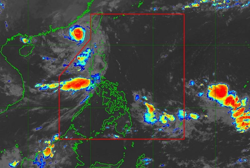
The center of the eye of Typhoon Jenny was estimated at 385 kilometers west northwest of Itbayat, Batanes outside the Philippine Area of Responsibility (PAR) packing maximum sustained winds of 120 kilometers per hour near the center, gustiness of up to 150 km/h, and central pressure of 975 hPa.
Jenny is moving westward at a speed of 10 km/h with strong to typhoon-force winds extend outwards up to 200 km from the center.
There are no wind signals hoisted at this time.
Hazards affecting land areas
Typhoon Jenny is less likely to directly bring heavy rainfall over the country throughout the forecast period.
The effect of the typhoon on the southwest monsoon has weakened, although the western section of Luzon may still experience some rain showers.
Ilocos Norte, Batanes, and Babuyan Islands will have cloudy skies with scattered rain showers and thunderstorms due to the trough of the typhoon with flash floods or landslides possibly occurring due to moderate to heavy rains.
Metro Manila, Zambales. Bataan, Cavite, Batangas, Occidental Mindoro, and the rest of Ilocos Region will have cloudy skies with scattered rain showers and thunderstorms due to the southwest monsoon. Flash floods or landslides may occur in these areas due to moderate to at times heavy rains.
The rest of the country will have partly cloudy to cloudy skies with isolated rain showers or thunderstorms due to the southwest monsoon and localized thunderstorms. Flash floods or landslides, however, may occur during severe thunderstorms.
Severe Winds
The lifting of all wind signals indicates that severe winds from Jenny will no longer affect the country.
Hazards affecting coastal waters
Northern and Central Luzon will experience moderate to strong wind speed moving in the southwest to south direction while coastal waters will be moderate to rough.
The rest of the country will experience light to moderate wind speed moving in the southwest to south direction with slight to moderate coastal waters.
The Gale Warning for coastal waters has been lifted but Jenny may still bring moderate to rough seas over the coastal waters of Batanes, the western portion of Babuyan Islands, Ilocos Norte, and Ilocos Sur in the next 24 hours.
PAGASA warned that "Mariners of motor bancas and similarly-sized vessels are advised to take precautionary measures while venturing out to sea and, if possible, avoid navigating in these conditions, especially if inexperienced or operating ill-equipped vessels."
Track and Intensity outlook
"Outside the PAR region, JENNY will continue to move westward (becoming west southwestward to southwestward by Sunday) slowly over the coastal waters of southeastern China," the weather bureau reported. — BAP, GMA Integrated News
