

Typhoon Jenny stronger, Signal No. 2 in Batanes
State weather bureau PAGASA raised storm signal Number 2 over Batanes as Typhoon Jenny continues to gather strength while moving northwestward over the Philippine waters.
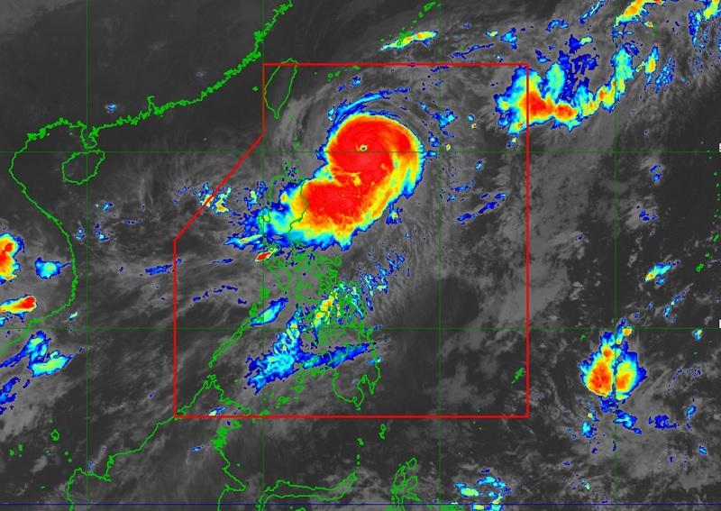
In its 11 p.m. bulletin, PAGASA said the center of the eye of the typhoon was last seen 410 kilometers east of Basco, Batanes at 10 p.m.
It is heading northwestward at 10 kilometers per hour (km/h) while packing maximum sustained winds of 165 km/h near the center and gustiness of up to 205 km/h.
Tropical Cyclones Wind Signal (TCWS) Signal No. 2 is hoisted over the following areas:
- Batanes
Storm signal No. 1 was hoisted in the following areas:
Cagayan including Babuyan Islands
- Northern and eastern portions of Isabela (Maconacon, Divilacan, Palanan, Santa Maria, San Pablo, Tumauini, Cabagan, Ilagan City, San Mariano, Santo Tomas, Dinapigue, Benito Soliven, Naguilian, Gamu, Quirino, Delfin Albano, Quezon, Mallig)
- Apayao
- Northeastern portion of Abra (Tineg, Lacub, Malibcong)
- Northern portion of Kalinga (Balbalan, Pinukpuk, Rizal, City of Tabuk)
- llocos Norte
Heavy rainfall
Jenny will continue to enhance the Southwest Monsoon (habagat) and will bring occasional rains over the western portions of Central Luzon, Southern Luzon, and Visayas in the next three days.
The typhoon is also expected to spur an accumulated rainfall of 50 to 100 millimeters (mm) in Batanes, Babuyan Islands, and the northeastern portion of mainland Cagayan from Monday evening to Tuesday evening.
On Tuesday afternoon to Wednesday morning, an accumulated rainfall of 100-200 mm may be experienced in Batanes; and 50-100 mm over Babuyan Islands, Ilocos Norte, the northern portion of Apayao, and the northwestern portion of mainland Cagayan.
Gale warning
A gale warning also remains in effect over the northern and eastern seaboards of Northern Luzon due to the effects of the tropical cyclone. Moderate to rough seas (2.0 to 4.0 m) will likewise be observed over the coastal waters of Isabela.
Mariners of motor bancas and similarly-sized vessels are advised to “take precautionary measures while venturing out to sea and, if possible, avoid navigating in these conditions, especially if inexperienced or operating ill-equipped vessels”.
On the forecast track, Jenny is seen to continue moving northwestward or west northwestward until Wednesday morning before turning generally westward thereafter.
The typhoon will make landfall over the southern portion of Taiwan on Thursday morning then exit the Philippine Area of Responsibility (PAR) on Thursday afternoon.
Outside the PAR region, it will continue moving westward slowly over the Taiwan Strait.
Meanwhile, PAGASA said Jenny is likely at or near its peak intensity and may begin to weaken on Tuesday due to increasing dry air entrainment and vertical wind shear.
Land interaction during its passage over the rugged terrain of southern Taiwan will further weaken the tropical cyclone. Once over the Taiwan Strait, additional cool dry air from the north will entrain into Jenny, resulting in continued weakening, the weather bureau added. — BAP, GMA Integrated News
