

Ineng maintains strength, seen to exit PAR by Wednesday
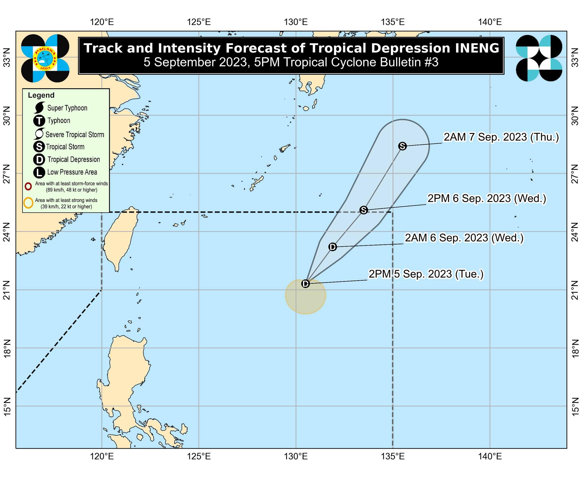
Tropical Depression Ineng maintains intensity as it continues northeast at 20 kph, and is expected to exit the Philippine Area of Responsibility tonight or Wednesday as a tropical storm, PAGASA said Tuesday.
In its 5 p.m. cyclone bulletin, the state weather bureau said the depression was last seen 1,020 kilometers east of extreme northern Luzon with maximum sustained winds of 45 kph near the center and gustiness of up to 55 kph.
While it has yet to affect the Philippines directly, Ineng is steadily enhancing the Southwest Monsoon or Habagat along with tropical storm Haikui (known in the Philippines as Hanna). The monsoon is set to bring occasional to monsoon rains over the western portions of Luzon over the next three days.
Meanwhile, gusty conditions are to be expected in the country despite no tropical cyclone wind signals being declared as another result of the enhanced Southwest Monsoon, especially in the coastal areas of Batanes, Ilocos Provinces, the western portion of Pangasinan, Zambales, and Bataan on Tuesday; and Batanes and Ilocos Provinces on Wednesday.
A gale warning is still in effect over seaboards of northern Luzon, the western seaboard of Central Luzon, the western and southern seaboards of Southern Luzon, and the western seaboard of Visayas.
Ineng is predicted to stay far from any Philippine landmass and is forecast to exit the Philippine Area of Responsibility by Tuesday night or Wednesday after intensifying into a Tropical Storm. — Jiselle Anne C. Casucian/BM, GMA Integrated News
