Typhoon Hanna out of PAR, but continues to enhance Habagat —PAGASA

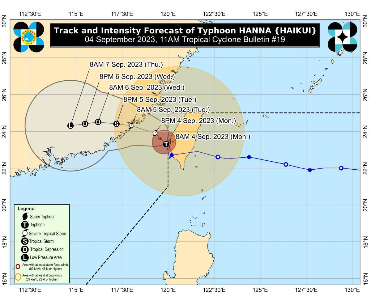
Typhoon Hanna left the Philippine Area of Responsibility (PAR) on Monday morning but it will continue to enhance the Southwest Monsoon or Habagat, state weather bureau PAGASA said.
In its 11 a.m. bulletin, PAGASA said the enhanced Habagat will bring occasional to monsoon rains over the western portion of Luzon in the next three days.
Gusty conditions are expected over Batanes, Babuyan Islands, Ilocos Region, Cordillera Administrative Region, Nueva Vizcaya, the southern portion of Aurora, Zambales, Bataan, Bulacan, Metro Manila, Occidental Mindoro, Romblon, Marinduque, the northern portion of Palawan including Calamian, Kalayaan, and Cuyo Islands, and most of Calabarzon, Bicol, and Western Visayas.
Due to Hanna and Habagat, a gale warning is in effect over the seaboards of Northern Luzon, the western and southern seaboards of Luzon, and the western seaboard of Visayas, PAGASA said.
“Disruption in civilian maritime activities is expected over these areas (e.g., suspension of sea travel) due to hazardous sea conditions,” it added.
Hanna is forecast to slowly move west northwestward over the Taiwan Strait while gradually weakening.
The typhoon is expected to make landfall over the coast of Guangdong or Fujian, China Tuesday morning or afternoon as a severe tropical storm.
It is also forecast to become a remnant low pressure area on late Wednesday or Thursday, according to PAGASA.
Classes, flights canceled
Several localities canceled classes on Monday due to inclement weather caused by Hanna and the Southwest Monsoon.
Some airlines also canceled their flights for Monday due to unfavorable weather condition. —KG, GMA Integrated News


