

Haikui slightly intensifies, seen to enter PAR Wednesday
Tropical Storm Haikui slightly intensified as it moved west northwestward over the Philippine Sea on Tuesday morning, state weather bureau PAGASA said.
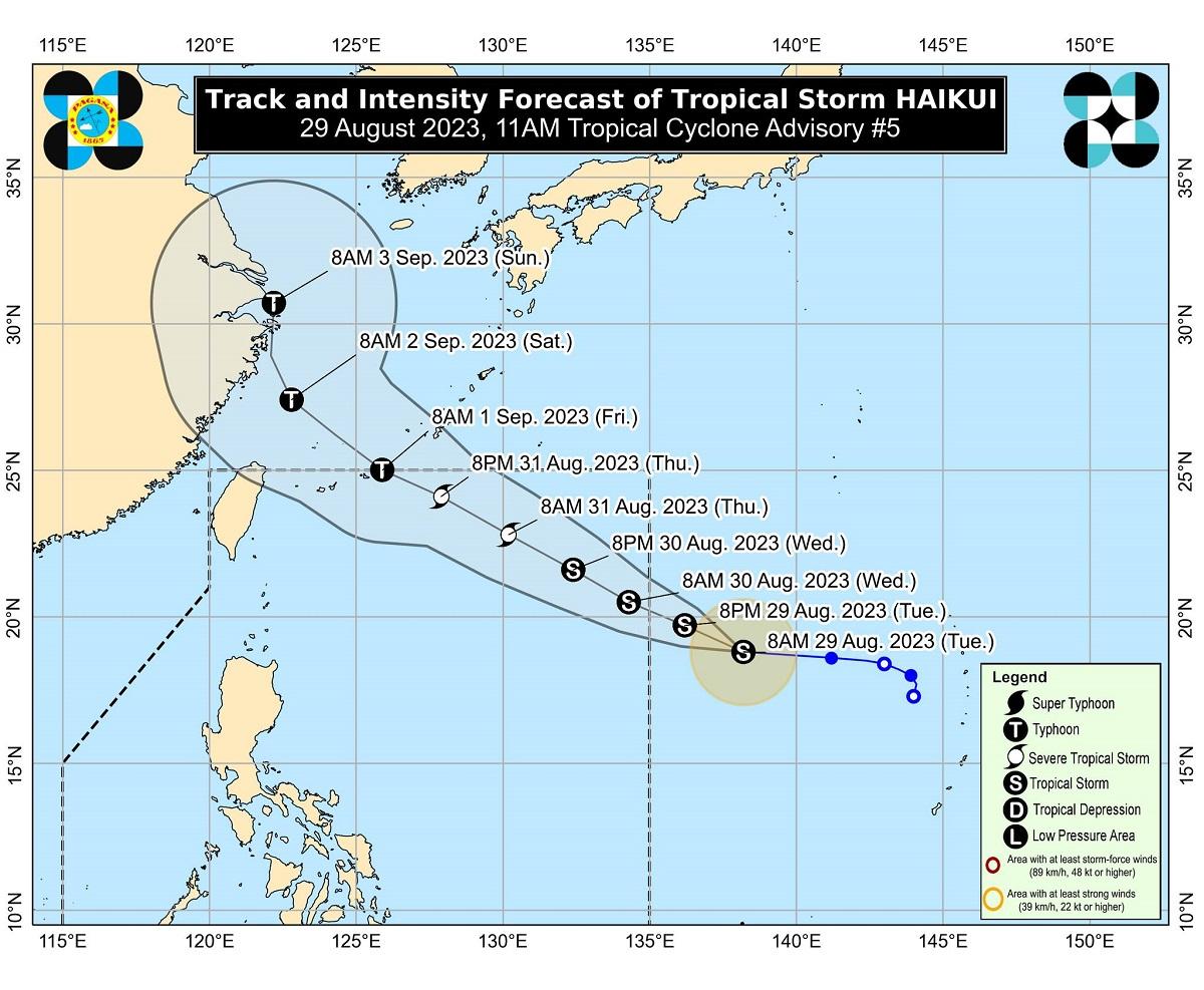
In its 11 a.m advisory, PAGASA said Haikui was still outside the Philippine Area of Responsibility (PAR) at 1,660 kilometers east of extreme northern Luzon. It was packing maximum sustained winds of 75 km per hour with gustiness of up to 90 km/h and central pressure of 996 hPa.
It said Haikui’s strong to gale-force winds extend outwards up to 200 kilometers from the center. The cyclone was moving west northwestward at 20 km/h.
PAGASA said Haikui may enter PAR on Wednesday morning and will be called “Hanna.”
Haikui is expected to remain far from the Philippine landmass and may exit PAR on Friday while approaching the Ryukyu Islands.
PAGASA said Haikui is seen to intensify within the next five days and may reach typhoon category within the PAR region. It may reach its peak intensity on Friday evening as it moves outside PAR.
While Haikui is less likely to directly affect the country, PAGASA said it will enhance the Southwest Monsoon or Habagat starting Wednesday or Thursday.
Due to this, occasional or monsoon rains are expected over the western portion of Luzon and Visayas throughout this week, PAGASA added. —Joviland Rita/KBK, GMA Integrated News
