

Tropical Storm outside PAR accelerates over Philippine Sea — PAGASA
Tropical Storm Haikui, which is outside the Philippine Area of Responsibility (PAR), maintains its strength as it accelerates westward over the Philippine Sea, PAGASA reported.
Aside from Typhoon Goring, the weather bureau is also monitoring the weather system outside PAR.
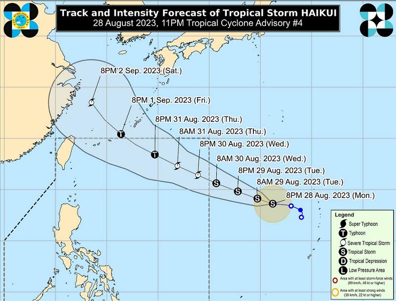
As of 11 p.m., the center of Tropical Storm Haikui was estimated at 1,965 kilometers east of Northern Luzon (outside PAR) packing maximum sustained winds of 65 kilometers per hour near the center, gustiness of up to 80 km/h, and central pressure of 998 hPa.
Haikui continues to move westward at a speed of 20 km/h with strong to gale-force winds extend outwards up to 200 km from the center.
The tropical storm is forecast to move west northwestward over the Philippine Sea until Friday and may enter PAR on Wednesday afternoon or evening.
Once inside the PAR, PAGASA said, it will be named “Hanna.”
"A generally northwestward turn may take place beginning Friday evening or Saturday morning as it moves over East China Sea," the bureau said.
Haikui is forecast to steadily intensify over the next five days and may reach severe tropical storm category within 48 hours (either prior or after entering PAR) and become a typhoon over the northeastern PAR region.
PAGASA said Haikui is less likely to directly affect the country but may enhance the southwest monsoon beginning on Wednesday or Thursday and may result in the continuation of occasional or monsoon rains over the western portion of Luzon and Visayas throughout the week. — BAP, GMA Integrated News
