

Goring nears super typhoon status
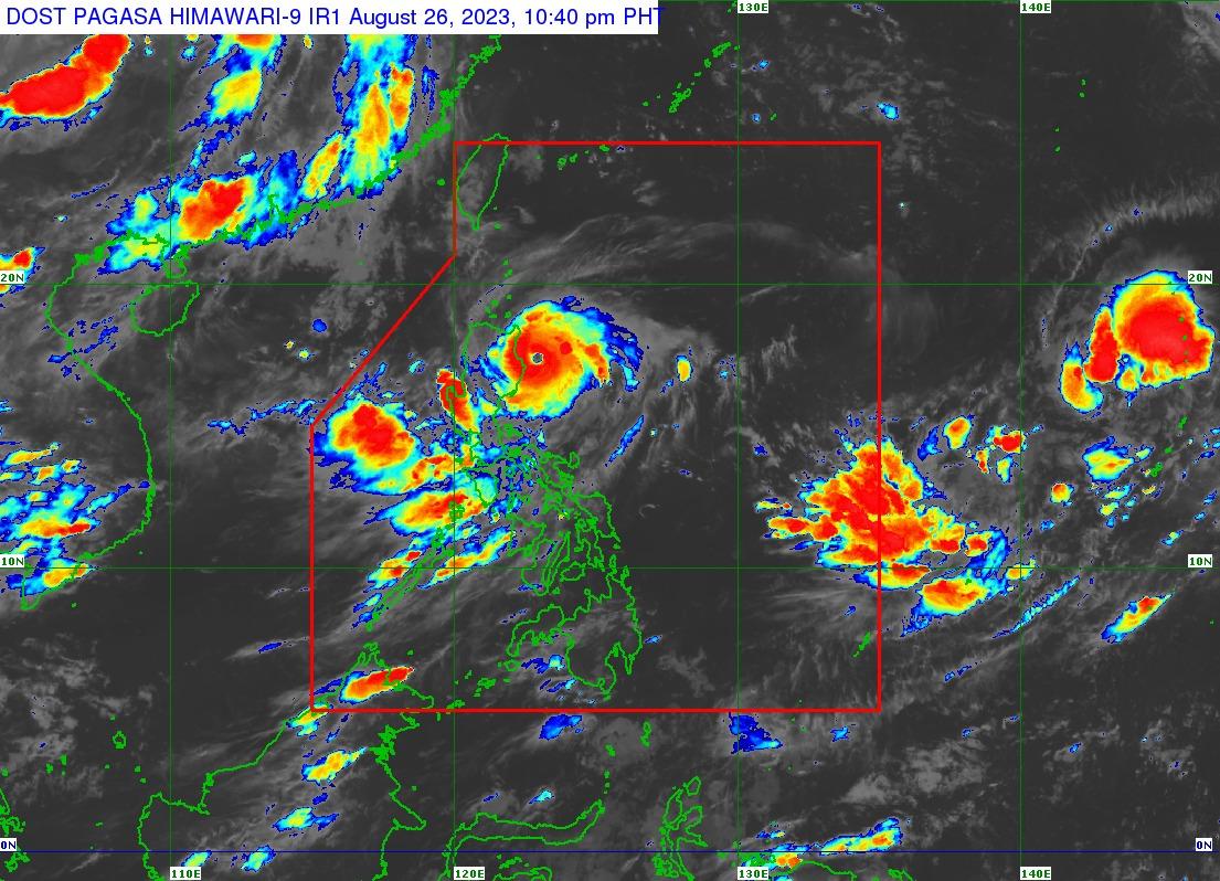
Typhoon Goring may reach the super typhoon category on Sunday as it intensifies further while moving over the coastal waters of Cagayan, PAGASA said late Saturday evening.
As of 10 p.m., Goring was located 135 kilometers east southeast of Tuguegarao City, Cagayan, with maximum sustained winds of 175 kilometers per hour near the center and gustiness of up to 215 km/h, the state weather bureau said in its 11 p.m. bulletin.
According to PAGASA, a tropical cyclone with a maximum wind speed exceeding 185 km/h is considered a super typhoon.
''Goring is forecast to reach [the] super typhoon category within the next 12 hours and achieve its peak intensity on Monday or Tuesday. Its landfall over the southern portion of Taiwan will result in significant [weakening], although it is forecast to remain a typhoon by the time it emerges over the Taiwan Strait on Thursday evening or Friday early morning,'' PAGASA said.
Moving southward at 10 km/h, Goring is expected to continue to go closer toward the coast of Isabela, and it will then turn generally southeastward and eastward on Sunday before turning northeastward on Monday.
Meanwhile, PAGASA hoisted Signal No. 3 over the extreme eastern portion of Isabela (Divilacan, Palanan)

- the eastern portion of mainland Cagayan (Peñablanca, Baggao, Gattaran, Lal-Lo, Gonzaga, Santa Teresita, Buguey, Santa Ana)
- the eastern portion of Isabela (Dinapigue, Ilagan City, Maconacon, Cabagan, Tumauini, San Pablo, Benito Soliven, San Mariano)
- the extreme northern portion of Aurora (Dilasag, Casiguran)
Placed under Signal No. 1 were the following areas:
- Batanes
- Babuyan Islands
- the rest of mainland Cagayan
- the rest of Isabela
- Quirino
- Nueva Vizcaya
- Apayao
- Kalinga
- Abra
- Mountain Province
- Ifugao
- the eastern portion of Benguet (Bokod, Buguias, Kabayan, Mankayan)
- the eastern portion of Ilocos Norte (Pagudpud, Adams, Vintar, Carasi, Nueva Era, Banna, Marcos, Dingras, Solsona, Piddig, Dumalneg, Bangui)
- the northeastern portion of Nueva Ecija (Carranglan, Pantabangan, Bongabon, Gabaldon, Laur, Rizal)
- the northern and central portions of Aurora (Dinalungan, Dipaculao, Baler, Maria Aurora, San Luis)
- Polillo Islands
- Calaguas Islands
''The hoisting of Wind Signal No. 4 is not ruled out should the short-term motion of Goring remains the same (e.g., slightly closer towards extreme eastern Isabela),'' PAGASA said.
The Southwest Monsoon or Habagat enhanced by Goring will bring occasional or monsoon rains over the western portions of Central Luzon, Southern Luzon, and Visayas over the next three days, PAGASA said.
The enhanced Southwest Monsoon will continue to bring gusty conditions over the following areas:
- Aurora
- Bataan
- Bulacan
- Metro Manila
- Calabarzon
- Mimaropa
- Bicol Region
- Visayas
- Dinagat Islands
- Camiguin
- most of Zamboanga Peninsula
A gale warning is in effect for Luzon's northern and eastern coastal waters, where disruption in civilian maritime activities is expected. —VBL, GMA Integrated News
