

Falcon leaves PAR, enhanced Habagat to continue causing rains
Typhoon Falcon has left the Philippine Area of Responsibility, PAGASA said on Tuesday.
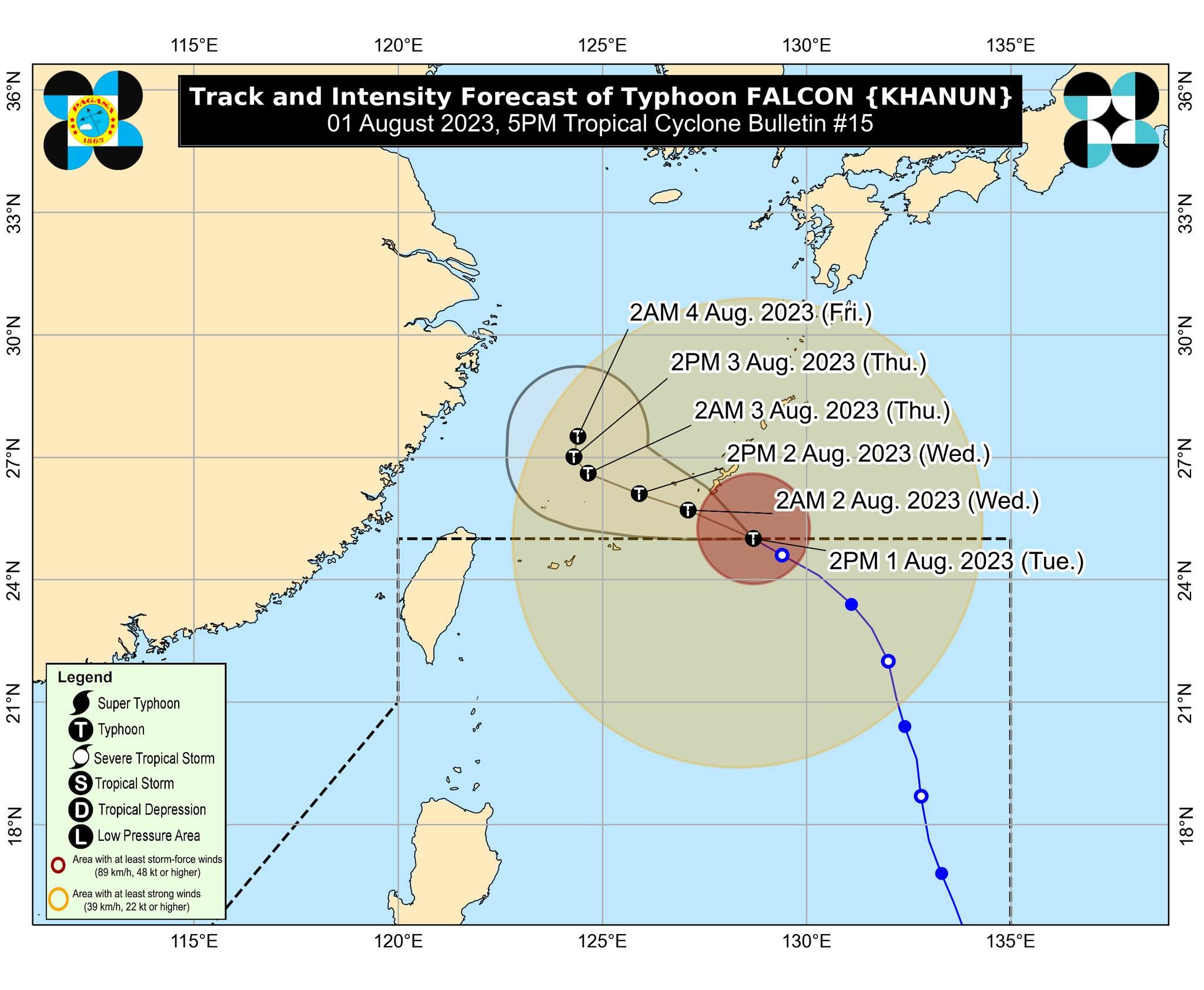
According to PAGASA's tropical cyclone bulletin late Tuesday afternoon, the center of the eye of typhoon was spotted at 4 p.m. to 835 kilometers northeast of extreme Northern Luzon.
Falcon was reported with maximum sustained winds of 175 km/h near the center and gustiness of up to 215 km/h.
No tropical cyclone wind signals issued as of the moment, but the enhanced Southwest Monsoon will bring gusty conditions over the following areas:
- On Tuesday
Batanes, Babuyan Islands, Abra, Benguet, Zambales, Bataan, the central and southern portions of Aurora, Pampanga, Bulacan, Metro Manila, and most of Ilocos Region, CALABARZON, MIMAROPA, Bicol Region, and Western Visayas
- On Wednesday
Batanes, Babuyan Islands, Ilocos Region, Nueva Vizcaya, Aurora, Zambales, Bataan, Bulacan, Pampanga, Metro Manila, CALABARZON, MIMAROPA, Bicol Region, the western portion of Northern Samar, and most of Cordillera Administrative Region and Western Visayas
- On Thursday
Batanes, Babuyan Islands, Ilocos Region, Cordillera Administrative Region, Nueva Vizcaya, Aurora, Zambales, Bataan, Bulacan, Pampanga, Metro Manila, CALABARZON, MIMAROPA, Bicol Region, Northern Samar, and Western Visayas
Within the next three days, the Southwest Monsoon enhanced by Typhoon Falcon will bring occasional monsoon rains over the western portion of Luzon.
Elevated or higher areas are to expect higher rainfall, which means flooding and rain-induced landslides are possible.
Gale warning
With the enhanced Southwest Monsoon, PAGASA said a gale warning is in effect over several coastal waters along the northern seaboard of northern Luzon. Sea travel is risky for small seacraft.
"For larger vessels, operating in gale conditions requires experience and properly equipped vessels. Mariners without proper experience or operating ill-equipped vessels are advised to remain in port or seek safe harbor," PAGASA said.
PAGASA said Falcon is forecast track west northwestward as it decelerates over the waters southeast of Okinawa Islands.
The typhoon will then pass south of Okinawa Islands between Tuesday night and Wednesday morning. A period of slow movement may occur by Thursday over the East China Sea, PAGASA said.
"Falcon is potentially at its peak intensity at this time and likely to maintain its strength for the next 48 hours, although intensification into a super typhoon is not ruled out," PAGASA said.
"A period of weakening may begin late tomorrow or on early Thursday as it enters the cooler waters of the East China Sea and as upwelling of deep ocean waters resulting from its slowdown limits further development," it added.
PAGASA said, "Considering these developments, the public and disaster risk reduction and management offices concerned are advised to take all necessary measures to protect life and property."
"Persons living in areas identified to be highly or very highly susceptible to these hazards are advised to follow evacuation and other instructions from local officials," PAGASA said. —NB, GMA Integrated News
