

Falcon intensifies into typhoon; ‘gusty conditions’ in parts of Luzon
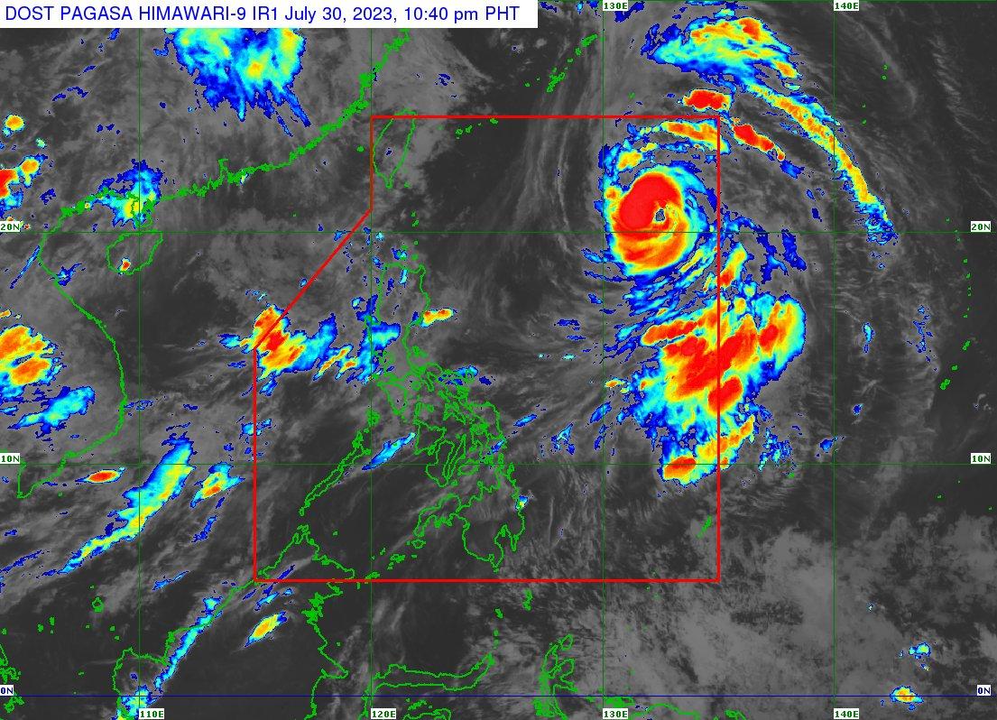
Falcon (international name: Khanun) has intensified into a typhoon and is set to bring rains over western Luzon over the next three days, PAGASA said late Sunday.
According to the state weather bureau's Tropical Cyclone Bulletin issued 11 p.m. on Sunday, Falcon’s center was estimated 1,090 kilometers east of extreme northern Luzon, moving west-northwestward at 15 kilometers per hour.
Its strength was recorded to have maximum sustained winds of 140 kilometers per hour near the center, and gustiness of up to 170 kilometers per hour.
The hoisting of storm signals is still seen as unlikely, but "gusty conditions" are expected over Zambales, Bataan, Cavite, Lubang Island, the Kalayaan Islands, Cuyo Islands, Romblon, northwestern Antique, Camarines Sur, and Albay on Sunday and Monday as Falcon enhances the Southwest Monsoon or Habagat to bring rains to these areas.
Falcon is projected to move north-northwest for the rest of Sunday until Monday morning, then turn northwest for the rest of the day.
“On the track forecast, the typhoon may exit the Philippine Area of Responsibility between tomorrow late evening and Tuesday morning,” the bulletin read.
Once it leaves the country’s area of responsibility, Falcon is set to pass very close over the Okinawa Islands in the Ryukyu Archipelago, while gradually decelerating. It is set to be over the East China Sea on Wednesday. — Jon Viktor D. Cabuenas/BM, GMA Integrated News
