

Falcon maintains strength while moving over Philippine Sea; Habagat brings rains
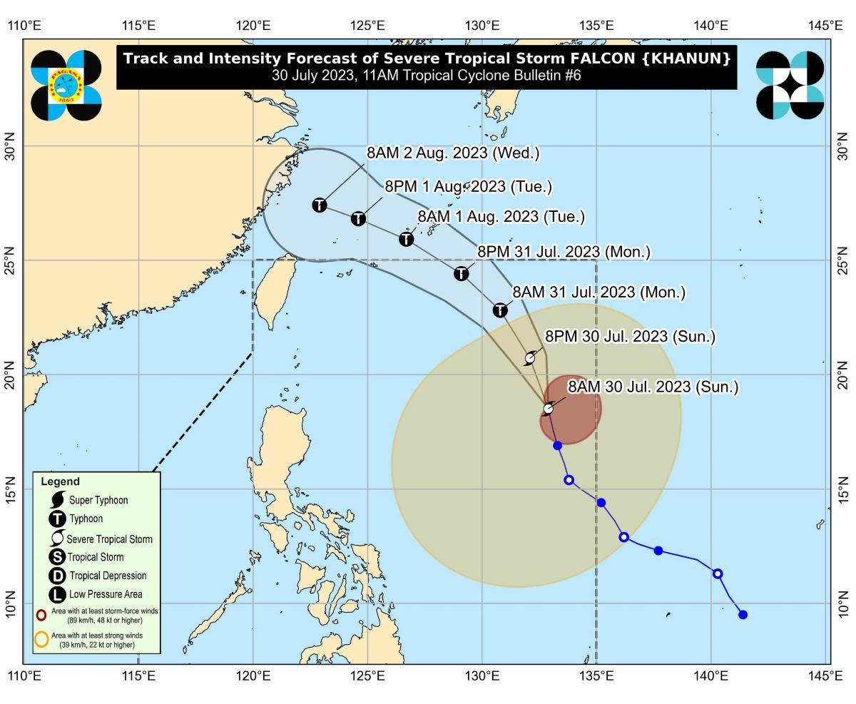
Severe Tropical Storm Falcon (international name: Khanun) has maintained its strength as it moved north westward over the Philippine Sea late Sunday morning, according to state weather bureau PAGASA.
Meanwhile, the Southwest Monsoon (Habagat) continues to bring rains over several alreas.
In its 11 a.m. bulletin, PAGASA said the center of the eye of Falcon was estimated to be located at 10 a.m. at 1,180 kilometers east of Northern Luzon.
The severe tropical storm was moving north northwestward at a speed of 15 km/h.
It has maximum sustained winds of 95 km/h near the center, gustiness of up to 115 km/h, and central pressure of 985 hPa.
Strong to storm-force winds also extended outwards up to 900 km from the center.
Falcon continued to enhance the Southwest Monsoon or Habagat, bringing occasional to monsoon rains over the western portions of Luzon and Visayas in the next three days, said PAGASA.
While hoisting of wind signals in any area remained unlikely based on the current forecast scenario, the state weather bureau said the enhanced Southwest Monsoon will bring gusty conditions over the following areas, especially in coastal and upland or mountainous areas exposed to winds:
- Sunday: Zambales, Bataan, Pampanga, Bulacan, Metro Manila, Occidental Mindoro, Palawan, Romblon, Northern Samar, and most of Calabarzon, Bicol Region and Western Visayas;
- Monday: Ilocos Norte, Pangasinan, Zambales, Bataan, Pampanga, Bulacan, Metro Manila, Occidental Mindoro, Palawan, Romblon, Northern Samar, and most of Calabarzon, Bicol Region and Western Visayas; and
- Tuesday: Ilocos Region, Abra, Benguet, Zambales, Bataan, Bulacan, Metro Manila, Bicol Region, and most of CALABARZON, MIMAROPA, and Western Visayas.
A gale warning is also in effect over several coastal waters along the western seaboard of Luzon due to the Habagat.
With this, PAGASA advised mariners without proper experience or operating ill-equipped vessels to stay in port or seek safe harbor.
Track, intensity
PAGASA said Falcon is seen to become a typhoon between Sunday late evening or Monday early morning, and reach its peak intensity on Tuesday.
It is expected to move north northwestward on Sunday, then turn northwestward on Monday.
It may then exit the Philippine Area of Responsibility (PAR) on Monday evening or on Tuesday early morning.
Falcon is also forecast to steadily intensify within the next three days.
Several parts of Central Luzon were flooded on Saturday due to the continuous rains brought by the combined effects of Severe Tropical Storm Falcon, Typhoon Egay, and the Southwest Monsoon or Habagat. —KG, GMA Integrated News
