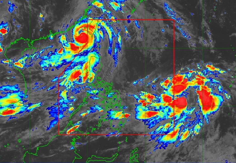
No more storm signals as Egay enters Taiwan strait

There are no wind signals raised in any part of the country as Typhoon Egay moves northward and enters the Taiwan Strait, PAGASA reported.
As of 10 p.m., the center of the eye of the typhoon was estimated at 315 kilometers west Northwest of Itbayat, Batanes packing maximum sustained winds of 150 kilometers per hour near the center, gustiness of up to 185 km/h, and central pressure of 955 hPa.
Egay is moving northward at the speed of 15 km/h with strong to typhoon-force winds extend outwards up to 480 km from the center.
There are no Tropical Cyclone Wind Signals hoisted at this time.
Hazards affecting land areas
"The Southwest Monsoon enhanced by Egay will continue to bring occasional to monsoon rains over the western portion of Luzon in the next three days," PAGASA said.
The forecast rainfall are generally higher in elevated or mountainous areas that may cause flooding and rain-induced landslides especially in susceptible areas.
Egay is no longer bringing severe winds over the country but the southwest monsoon or habagat enhanced by Egay will continue to bring gusty conditions over Luzon and Western Visayas on Friday.
Hazards affecting coastal waters
A Gale Warning is in effect over several coastal waters along the seaboards of Luzon and the eastern and western seaboards of Visayas. The bureau said rough to very rough seas may occur so sea travel is risky for small seacrafts.
For larger vessels, PAGASA added, operating in gale conditions requires experience and properly equipped vessels.
Track and Intensity Outlook
Typhoon Egay is forecast to track northward or north northwestward over the Taiwan Strait and make landfall over Fujian, China on Friday morning. Rapid weakening will ensue as the typhoon moves inland over China. — BAP, GMA Integrated News


