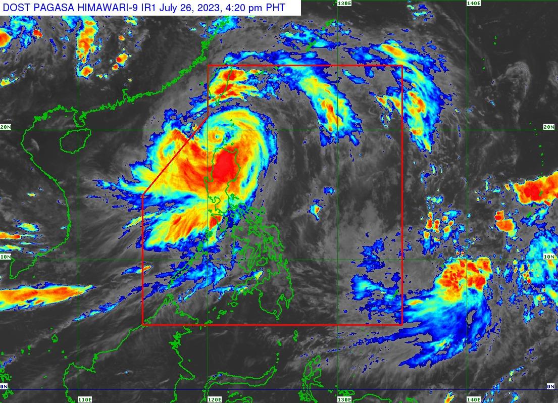
Egay maintains strength; Signal No. 4 over areas in Cagayan, Ilocos Norte

Signal No. 4 remains hoisted over areas in northwestern Cagayan and northern Ilocos Norte as Typhoon Egay continues its way northwest, PAGASA said.
According to the state weather bureau's 5 p.m. bulletin, Egay currently has sustained winds of 175 km/h near the center and gustiness of up to 240 km/h.
The eye of the storm was last estimated to be located 70 kilometers west northwest of Calayan, Cagayan. The storm was last seen moving northwestward at 10 km/h and is predicted to make its way towards the Taiwan Strait.
The following areas are under Signal No. 4:
- the northwestern portion of Cagayan (Claveria, Sanchez-Mira, Pamplona, Abulug, Ballesteros, Santa Praxedes) including Babuyan Islands
- the northern portion of Ilocos Norte (Burgos, Bangui, Dumalneg, Pagudpud, Adams)
"Violent, life-threatening conditions" are expected in these areas as well as inthe northern portions of Apayao in the next six hours, PAGASA warned, as typhoon-force winds with speeds ranging from 118 to 184 km/h expected.
The following areas are under Signal No. 3:
- Batanes
- northern and central portions of Cagayan (Gattaran, Lal-Lo, Alcala, Allacapan, Lasam, Baggao, Amulung, Rizal, Santo Niño, Piat, Santa Ana, Gonzaga, Santa Teresita, Buguey, Camalaniugan, Aparri)
- the rest of Ilocos Norte
- Apayao
- the northern portion of Abra (Tineg, Lagayan, Lacub, Danglas, San Juan)
- the northern portion of Ilocos Sur (Cabugao, Sinait)
These areas may feel the effects of winds with speeds of 89 km/h to 117 km/h.
The following areas are under Signal No. 2:
- Kalinga
- Mountain Province
- Ifugao
- Isabela
- the rest of Cagayan
- the rest of Ilocos Sur
- the rest of Abra
- the northern and central portions of La Union (Luna, Caba, Santol, Bauang, City of San Fernando, San Juan, Bagulin, Bangar, San Gabriel, Burgos, Naguilian, Bacnotan, Sudipen, Balaoan, Aringay)
- the northern and central portions of Benguet (Mankayan, Kapangan, Atok, Kabayan, Kibungan, La Trinidad, Sablan, Bakun, Buguias, Tublay, Bokod)
The following areas are forecast to experience winds greater than 62 km/h up to 88 km/h within the next 24 hours with moderate to light threat to high-risk structures.
The following areas are under Signal No. 1:
- Quirino
- Nueva Vizcaya
- Aurora
- Pangasinan
- Nueva Ecija
- Tarlac
- Zambales
- Bataan
- Bulacan
- Pampanga
- Metro Manila
- Cavite
- Rizal
- Laguna
- the rest of La Union and the rest of Benguet
- the northern portion of Quezon (Infanta, General Nakar, Real, Lucban, Sampaloc, Mauban) including Pollilo Islands
Areas under signal number 1 may experience winds of 39 to 61 km/ph and intermittent rains within the next 36 hours, with little to no threats to property.
Rainfall
More than 200 mm of rainfall are to be expected in areas near the northwestern portion of Cagayan including Babuyan Islands, and Ilocos Norte.
100-200 mm rainfall will be experienced in Batanes, Ilocos Sur, the rest of Cagayan, Apayao, and Abra, while 50-100 mm rains fall in Zambales and the rest of Cordillera Administrative Region and Ilocos Region.
For the next three days, the Southwest Monsoon enhanced by Egay will continue to bring occasional to monsoon rains over the western portions of Central Luzon, Southern Luzon, and Visayas.
A gale warning has also been raised over several coastal waters along the seaboards of Luzon and Visayas.
Sea travel has been deemed risky for most vessels due to rough to high or very high seas.
There is also a high risk of storm surge exceeding 3.0 meters in most warning areas including the low-lying and exposed coastal areas of Batanes, Cagayan including Babuyan Islands, Ilocos Norte, and portions of Isabela and Ilocos Sur.
Track and intensity outlook
Egay is predicted to weaken gradually as a result of the slightly favorable environment offsetting the impact of land interaction with the rugged terrain of northern Luzon and Taiwan.
Egay is forecast to exit the Philippine Area of Responsibility by Thursday morning, and degenerate into a remnant low by Saturday after its landfall in mainland China. — Jiselle Anne C. Casucian/BM, GMA Integrated News


