

Dodong exits PAR; rains to persist due to habagat
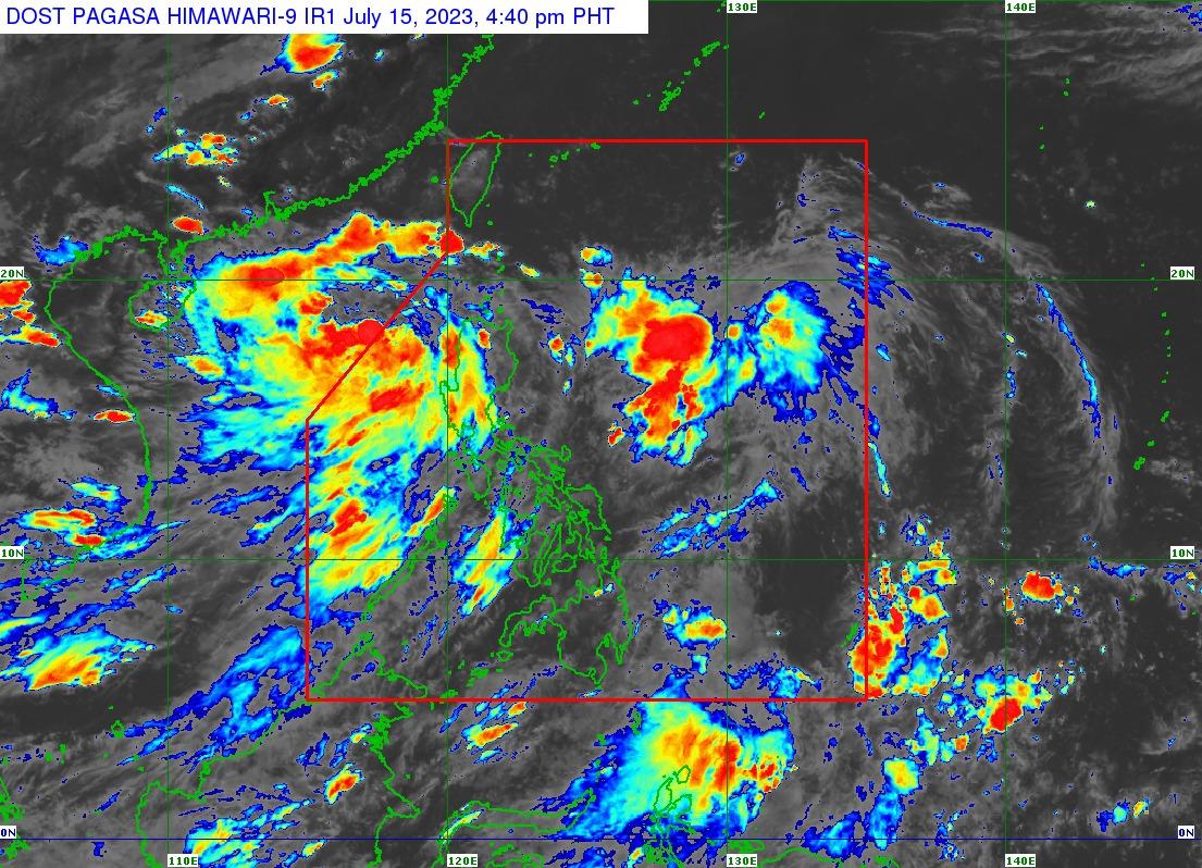
Tropical Storm Dodong exited the Philippine Area of Responsibility (PAR) on Saturday afternoon, but it continues to enhance the Southwest Monsoon or habagat, according to state weather bureau PAGASA.
Although all wind signals have been lifted, the enhanced Southwest Monsoon may still bring gusty conditions over the following areas:
Ilocos Region, Cordillera Administrative Region, Batanes, the eastern portion of Isabela, Quirino, Nueva Vizcaya, Zambales, Bataan, Bulacan, Pampanga, Aurora, Metro Manila, CALABARZON, MIMAROPA, Bicol Region, and Western Visayas.
According to PAGASA's 5 p.m. weather bulletin, Tropical Storm Dodong was estimated at 305 km West of Sinait, Ilocos Sur (18.3°N, 117.6°E).
It is moving Southeastward Slowly, with maximum sustained winds of 65 km/h near the center, gustiness of up to 80 km/h, and central pressure of 994 hPa.
The rest of the country will have partly to cloudy to cloudy skies with isolated rainshowers or thunderstorms due to the Southwest Monsoon and localized thunderstorms.
The northern and western section of Luzon will have strong wind speed moving Southwest to South direction while coastal waters will be rough.
Visayas and the rest of Luzon will have moderate to strong wind speed moving Southwest to Southeast while the coastal waters moderate to rough.
Mindanao will have light to moderate wind speed moving Southwest and slight to moderate coastal waters.
The sun will set at 6:29 p.m. today. —Sherylin Untalan/ VAL, GMA Integrated News
