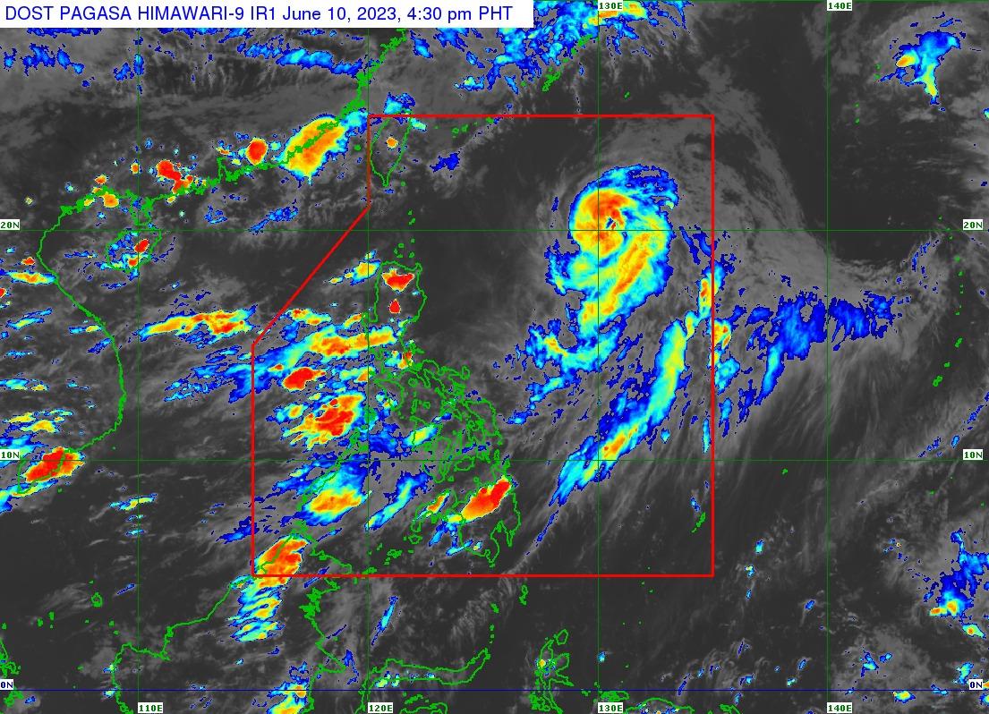
Chedeng maintains strength; occasional rains to come from Habagat —PAGASA

Typhoon Chedeng maintained its strength on Saturday while accelerating north-northeastward over the Philippine Sea but is unlikely to directly bring heavy rainfall, according to PAGASA.
However, the Southwest Monsoon or Habagat, will bring occasional rains over the western portions of Luzon and Visayas, including Metro Manila, CALABARZON, MIMAROPA, Bicol Region, Visayas, Zambales, Bataan, Camiguin, and Dinagat Islands.
Typhoon Chedeng was last spotted 860 km East of Extreme Northern Luzon (20.1°N, 130.2°E), moving North-Northeastward at 20 km/h. It contains a maximum sustained winds of 150 km/h near the center and gustiness of up to 185 km/h.
Chedeng is forecast to maintain its strength within 12 hours before entering a weakening trend on Sunday. It is forecast to leave the Philippine Area of Responsibility (PAR) between tomorrow late evening or Monday early morning.
PAGASA warned of possible flash floods or landslides due to moderate to at times heavy rains.
Meanwhile, the rest of the country will have partly cloudy to cloudy skies with isolated rain showers or thunderstorms due to Southwest Monsoon and localized thunderstorms. Possible flash floods or landslides during severe thunderstorms is expected.
The wind speed in Northern and Central Luzon will be moderate to strong, moving southwest and the coastal waters will be moderate to rough.
The rest of the country will have moderate wind speed moving south to southwest, and coastal waters will also be moderate. —Sherylin Untalan/ VAL, GMA Integrated News


