

Chedeng intensified but unlikely to directly bring heavy rains —PAGASA
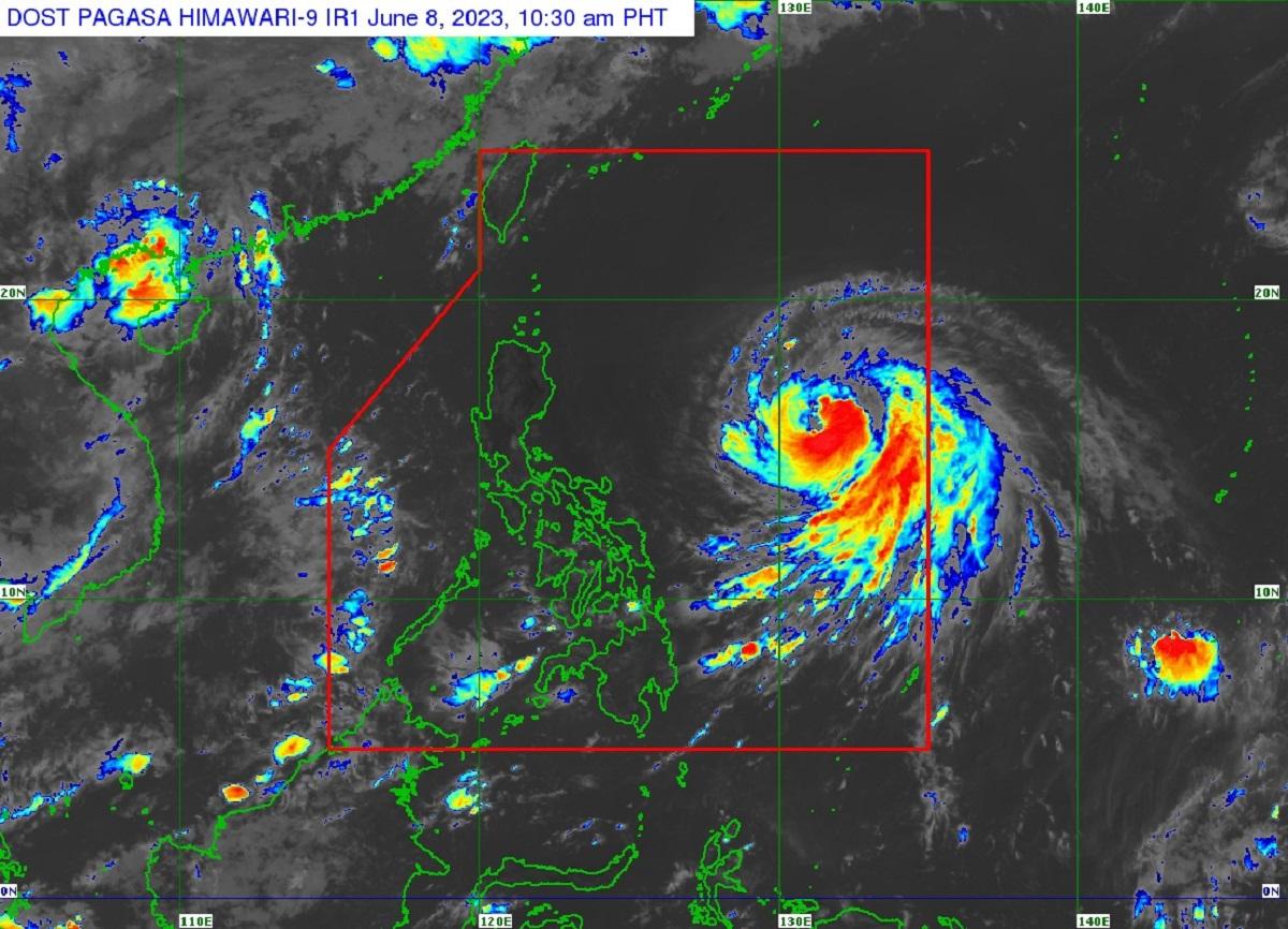
Severe Tropical Storm Chedeng slightly intensified as it moved northwestward over the Philippines Sea, state weather bureau PAGASA said Thursday.
In its 11 a.m. advisory, PAGASA said no Tropical Cyclone Wind Signals are raised in the country and Chedeng is unlikely to directly bring heavy rainfall over any portion of the country in the next three to five days.
However, Chedengor may enhance the Southwest Monsoon or Habagat, which may bring rains and gusty conditions to some parts of the country, PAGASA said.
At 10 a.m., Chedeng was located at 1,070 kilometers east of Central Luzon packing maximum sustained winds of 100 kilometers per hour (km/h) and gustiness of up to 125 km/h. Its strong to gale-force winds, meanwhile, extend outwards up to 350 km from the center.
PAGASA said Chedeng is moving west northwestward at 15 km/h.
Chedeng may be upgraded into a typhoon by Thursday evening or Friday and its peak intensity may be reached by Saturday but it will remain far from the Philippine landmass, PAGASA said.
“The timing and intensity of monsoon rains over the country (especially in the western portion) may still change due to the dependence of monsoon enhancement on the forecast movement and intensity of Chedeng as well as its interaction with the other weather systems surrounding it,” PAGASA said.
PAGASA advised the public to keep checking for updates regarding the possible enhancement of the Southwest Monsoon.
The state weather bureau said gusty conditions may be experienced in coastal and upland/mountainous areas exposed to winds particularly in Visayas, Romblon, Occidental Mindoro, the northern portion of Palawan including Kalayaan, Calamian, and Cuyo Islands, Surigao del Norte, Dinagat Islands, and Camiguin on Friday.
The same condition may also be experienced on Saturday in Visayas, Calabarzon Mimaropa, Bicol, Camiguin, and Dinagat Islands.
Chedeng is expected to move generally west northwestward to northwestward on Thursday through Friday before turning more northward on Thursday evening. It will be slow-moving until Saturday before accelerating on Sunday generally north northeastward or northeastward.
Chedeng is expected to exit the Philippine Area of Responsibility by Monday morning, PAGASA said. —Joviland Rita/KBK, GMA Integrated News
