Florita intensifying into storm; floods, landslides likely —PAGASA

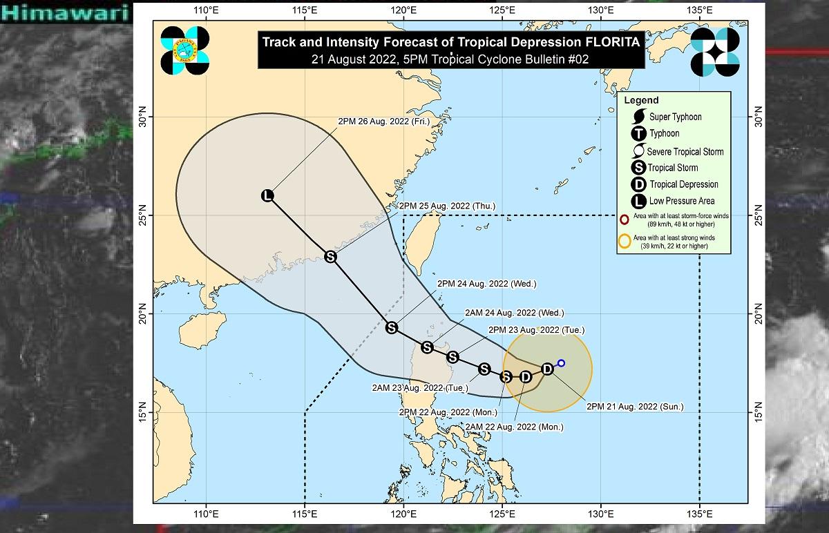
Tropical Depression Florita is seen to intensify and reach tropical storm category on Monday morning with rains expected over northern Luzon, the state weather bureau announced over the weekend.
According to the Philippine Atmospheric, Geophysical, and Astronomical Services Administration (PAGASA), Florita may reach a peak intensity of 75 kilometers per hour.
It is expected to continue moving generally west-southwestward in the next 12 hours, before shifting westward on Monday morning then west northwestward by Tuesday towards northern Luzon.
“Under these conditions, scattered to widespread flooding and rain-induced landslides are expected especially in areas that are highly or very highly susceptible to these hazard…” the bulletin read.
The center of the tropical cyclone is expected to make landfall in Cagayan or the northern portion of Isabela on Tuesday morning or afternoon, before moving west northwestward crossing several provinces.
It is set to bring in light to moderate with at times heavy rains over Cagayan, Isabela, Batanes, and Aurora. It will then bring heavy to intensive with at times torrential rains over Batanes, Cagayan, Isabela, the Cordillera Administrative Region, and Ilocos on Monday evening through Tuesday evening.
Light to moderate with at times heavy rains are also expected over Central Luzon and the rest of the Cagayan Valley, before Florita emerges over the West Philippine Sea by Wednesday early morning. —LBG, GMA News


