Tropical Storm Domeng now outside PAR

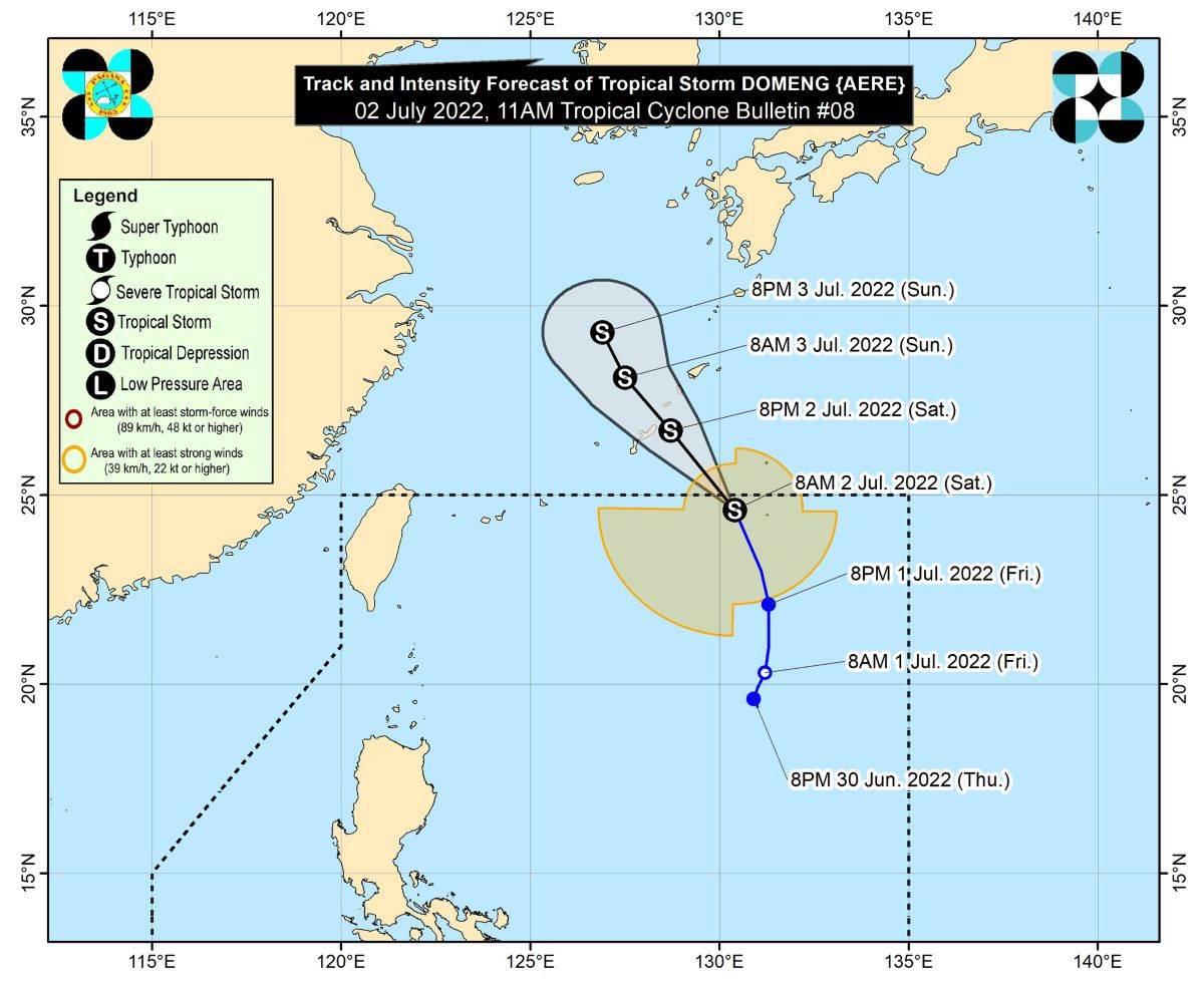
Tropical Storm Domeng (international name: Aere) has exited the Philippine Area of Responsibility (PAR) on Saturday morning, PAGASA said.
As of 10 a.m., Domeng's center was located at 990 kilometers east northeast of Extreme Northern Luzon, which is outside PAR, the weather bureau said in its 11 a.m. bulletin.
It has maximum sustained winds of 85 km/h near the center, gustiness of up to 105 km/h, and central pressure of 994 hPa.
Domeng was moving north northwestward at 30 km/h and is expected to pass very close to or over the Ryukyu Islands of Japan on Saturday night. It will then turn north northwestward on Sunday over the East China Sea.
From its center, strong to gale-force winds are extending outwards up to 400 km.
"'DOMENG' is forecast to remain tropical storm in the next 36 hours," PAGASA said.
"Tropical Storm 'DOMENG' is not directly affecting the archipelago within the forecast period," it added.
However, a gale warning remains in effect over the western seaboards of Northern and Central Luzon due to the influence of Domeng, Typhoon Chaba and the Southwest Monsoon (Habagat).
The remaining seaboards of Northern Luzon and western seaboard of Southern Luzon will also experience moderate to rough seas, with waves possibly reaching up to 4 meters high, making it risky for small seacraft.
PAGASA advised the public and disaster risk reduction and management offices concerned to take the necessary precautions. —KG, GMA News


