Signal No. 2 raised over Kalayaan Islands as Vicky intensifies into tropical storm

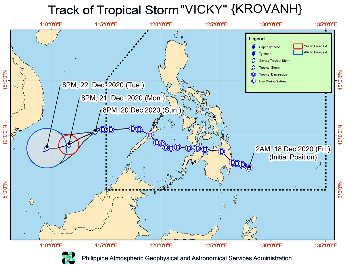
PAGASA raised Tropical Cyclone Wind Signal No. 2 over the Kalayaan Islands late Sunday night as Vicky intensified into a tropical storm outside the Philippine Area of Responsibility (PAR).
In its 11 p.m. bulletin, the state weather bureau said Vicky became a tropical storm at 8 p.m. Sunday and remained less likely to further intensify.
Vicky was last spotted 85 kilometers south-southwest of Kalayaan, Palawan carrying maximum sustained winds of 65 kilometers per hour (kph) near the center and gustiness of up to 80 kph.
The cyclone continues to move westward at 20 kph and was forecast to move west-southwestward or southwestward within the next 24 hours over the West Philippine Sea before moving more westward by Tuesday.
Hazards
PAGASA said strong to gale-force winds would prevail due to Vicky and the Northeast Monsoon or Amihan in the Kalayaan Islands, Batanes, Babuyan Islands, and the northern portions of Cagayan, Apayao, and Ilocos Norte.
Occasional gusty conditions were also forecast over the eastern portions of mainland Cagayan, Isabela, Aurora, Quezon, and Palawan including the Calamian Islands.
Moderate to heavy rains should be expected over the Kalayaan Islands, the eastern portion of mainland Cagayan Valley, Aurora, and the northern portion of Quezon, while light to moderate with at times heavy rains will persist over the rest of mainland Cagayan Valley, Babuyan Islands, Apayao, Kalinga, Mountain Province, Ifugao, and the rest of Quezon province.
Meanwhile, Amihan and Vicky were forecast to bring rough to high seas over the entire seaboard of Northern Luzon and rough to very rough seas over parts of Central Luzon, northern Quezon including the northern and eastern waters of Polillo Islands, Camarines Norte, Camarines Sur, Catanduanes, Lubang Island, and Palawan including Calamian and Kalayaan Islands.
“Sea travel is risky over these waters especially for small sea vessels,” PAGASA said. — Julia Mari Ornedo/BM, GMA News


