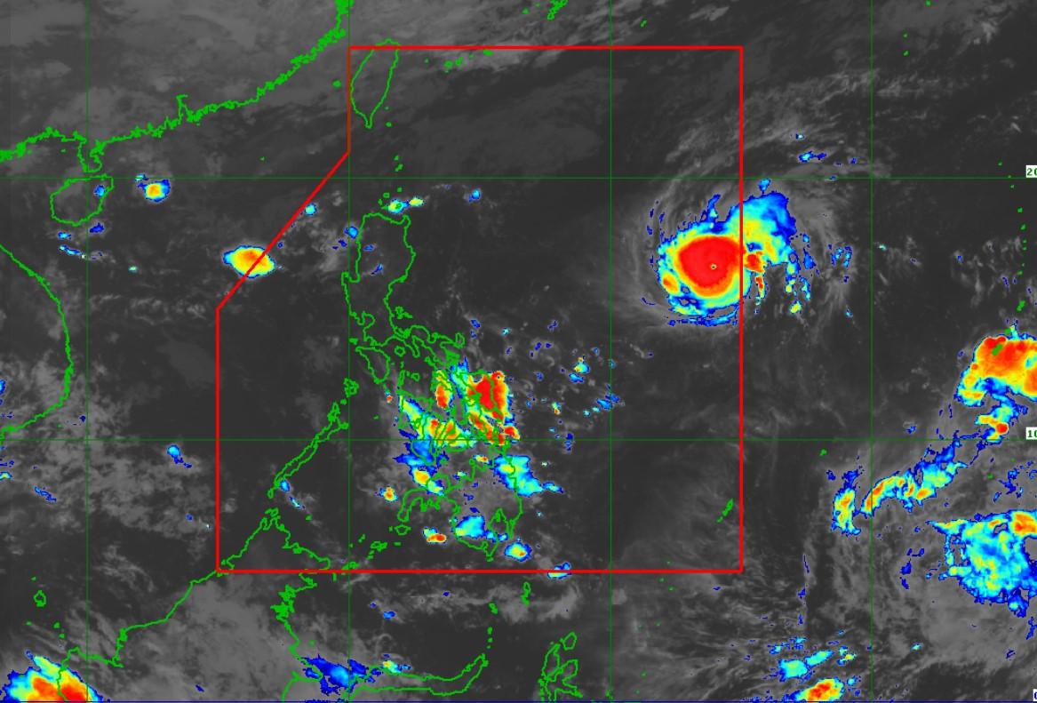
Stronger Rolly now a typhoon, Signal No. 1 seen over Bicol on Friday

Severe tropical storm Rolly rapidly intensified into a typhoon after entering the Philippine Area of Responsibility (PAR), PAGASA announced Thursday night.
In its 11 p.m. severe weather bulletin, the weather agency said Rolly developed into a typhoon at 8 p.m. and rapidly intensified over the past hours.
It is expected to further intensify over the Philippine Sea and make landfall at a peak intensity of 165 to 185 kilometers per hour.
Rolly may make landfall over the Central Luzon-Quezon area on Sunday evening or Monday morning.
PAGASA said Signal No. 1 could be raised in the Bicol Region on Friday morning. Meanwhile, the highest storm signal which may be issued are Signal No. 3 or No. 4.
At 10 p.m. on Thursday, the eye of Rolly was located at 1,280 kilometers east of Central Luzon with maximum sustained winds of 120 kph near the center and gustiness of up to 150 kph.
It is moving westward at 20 kph.
Hazards
Due to rough to very rough seas, gale warnings have been raised over the seaboards of Batanes, Babuyan Islands, Ilocos Norte, and Ilocos Sur and the northern seaboard of mainland Cagayan.
PAGASA said that sea travel is “risky” over said areas.
Meanwhile, moderate to rough seas may prevail over the remaining seaboards of Northern Luzon.
Mariners of small seacraft are advised to take precautionary measures when venturing out to sea. Inexperienced mariners should avoid navigating in these conditions,” it said.
Other tropical systems
At 8 p.m. on Thursday, the tropical depression outside PAR being monitored by PAGASA developed into a tropical storm and was named “Atsani.”
The center of Atsani was estimated at 2,430 km east of Mindanao with maximum sustained winds of 65 kph near the center and gustiness of up to 80 kph.
It is moving northward at 20 kph and may enter PAR on Sunday or Monday.
The next severe weather bulletin on Rolly is set to be released at 11 a.m. on Friday. -NB, GMA News


