Tropical Depression Nika seen to exit PAR on Monday

Tropical Depression Nika, which developed from a low-pressure area on Sunday night, is expected to exit the Philippine Area of Responsibility (PAR) between Monday morning and afternoon, PAGASA said.
In its 11 p.m. bulletin, the state weather bureau did not raise any tropical cyclone wind signals.
“However, the enhancement of both the Southwest Monsoon and the Northeasterly Surface Windflow will bring strong winds with occasional gusts over the northern and western section of Luzon, especially in coastal and mountainous areas,” it said.
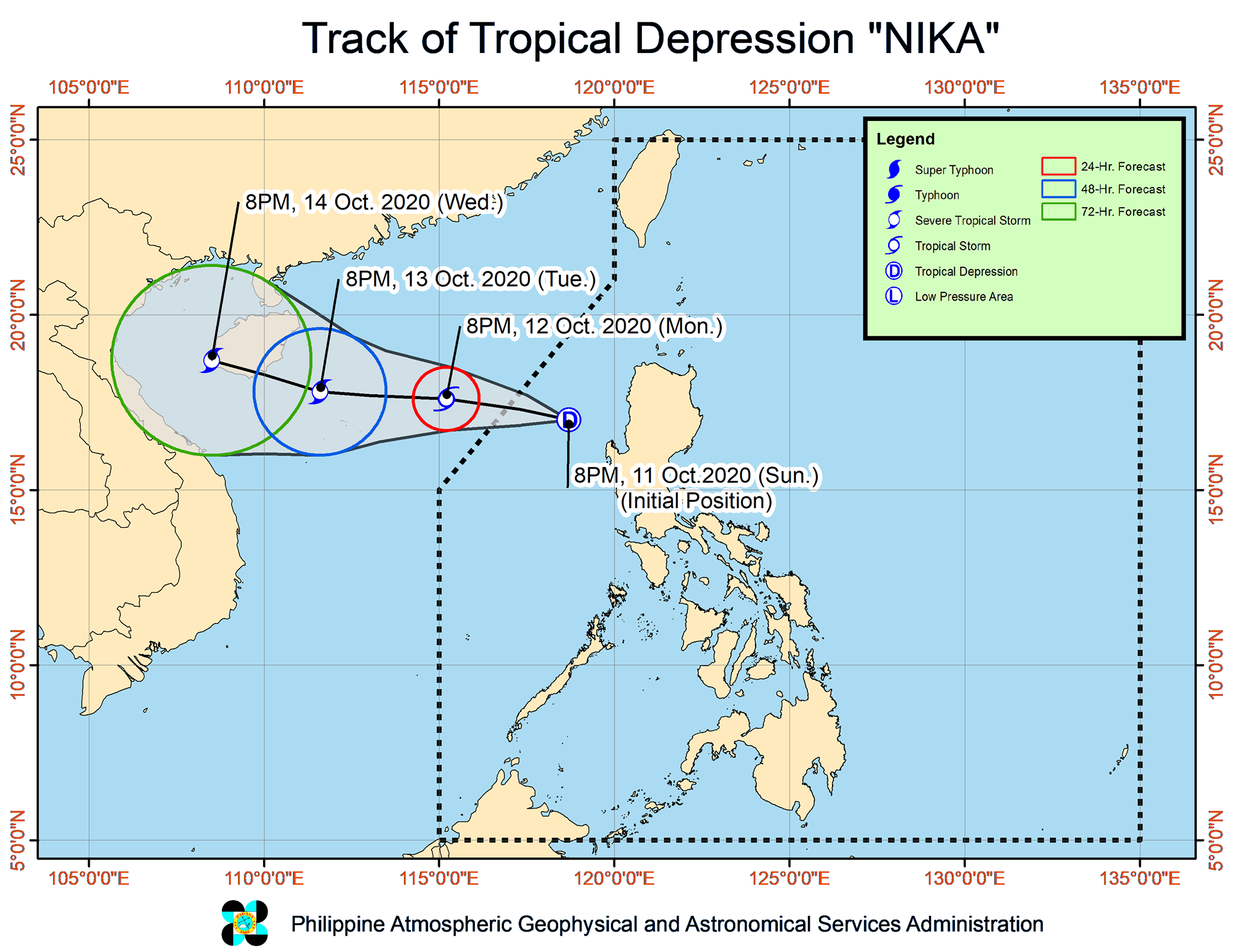
Nika was last seen 200 kilometers west-southwest of Sinait, Ilocos Sur packing maximum sustained winds of 55 kilometers per hour (kph) and gustiness of up to 70 kph.
The cyclone is moving westward at 15 kph.
PAGASA said Nika will make landfall over Hainan Province in China on Wednesday morning.
Weather outlook
PAGASA said moderate to heavy rains should be expected between Sunday night and Monday night over southern Isabela, Quirino, Nueva Vizcaya, Mountain Province, Ifugao, Benguet, La Union, Pangasinan, Central Luzon, Rizal, and northern Quezon including Polillo Islands.
Light to moderate with at times heavy rains will also prevail over Metro Manila and the rest of Luzon.
PAGASA added that a gale warning is in effect for the seaboards of Batanes, Cagayan, Ilocos Norte, Ilocos Sur, La Union, Pangasinan, Zambales, and Bataan due to rough to very rough seas.
It also said moderate to rough seas will be experienced over the other seaboards of Luzon.
Forecast positions
By Monday evening, Nika is expected to be 550 kilometers west of Sinait, Ilocos Sur.
By Tuesday evening, it will be 930 kilometers west of Northern Luzon.
By Wednesday evening, the cyclone will be 1,265 kilometers west of Northern Luzon. — Julia Mari Ornedo/BM, GMA News


