

Typhoon Kristine not seen to directly affect Philippine weather —PAGASA
Typhoon Kristine, which entered the Philippine area of responsibility on Friday morning, is unlikely to directly affect the country's weather condition as it will remain far from landmass, PAGASA said.
In its 11 a.m. weather bulletin on Friday, PAGASA said Kristine is forecasted to move west-northwestward and northwestward while inside PAR.
However, Kristine, with international name Haishen, may bring rough to very rough seas over the northern and eastern seaboards of northern Luzon beginning Friday night or Saturday morning.
Sea travel will be risky under such sea conditions, PAGASA warned.
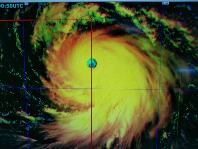
As of 10 a.m. on Friday, the eye of Typhoon Kristine was located based on all available data at 1,340 km east of extreme northern Luzon (21.8 °N, 134.8 °E).
It is moving northwestward at 15 kph, with maximum sustained winds of 185 kph near the center and gustiness of up to 230 kph.
PAGASA said the typhoon is undergoing rapid intensification at the moment, and is forecasted to reach peak intensity of around 205-215 km/h on Sunday.
No Tropical Cyclone Wind Signal has so far been issued.
Kristine is expected to exit PAR between Saturday evening and early Sunday morning and head towards southern Japan and the Korean Peninsula. —Jamil Santos/KBK, GMA News
