

Typhoon Julian intensifies ahead of exit from PAR
Typhoon Julian intensified further ahead of its expected exit from the Philippine Area of Responsibility (PAR) on Monday evening or Tuesday morning, PAGASA said late Sunday night.
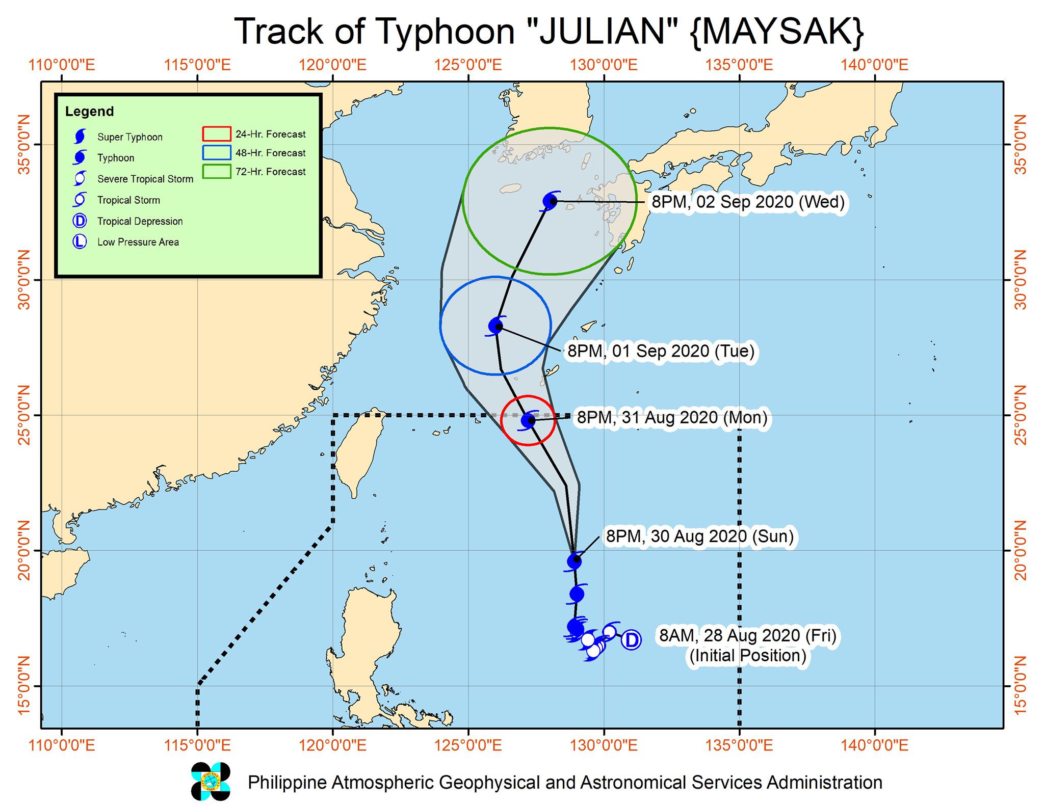
In its 11 p.m. severe weather bulletin, the state weather bureau said Julian was last seen 715 kilometers east of Basco, Batanes packing maximum sustained winds of 150 kilometers per hour (kph) and gustiness of 185 kph.
It continues to move northward at 20 kph and is expected to reach peak intensity on Monday or Tuesday.
“On the forecast track, the tropical cyclone will remain far from the landmass,” PAGASA said.
It added that Tropical Cyclone Wind Signals are unlikely to be raised throughout the forecast period.
Weather outlook
PAGASA said light to moderate with at times heavy rains will prevail through Sunday night until Monday afternoon over Ilocos Region, Cordillera Administrative Region, Batanes, Babuyan Islands, Cagayan, Isabela, Aurora, Zambales, Bataan, Cavite, Batangas, Occidental Mindoro, and Northern Palawan including Calamian Islands.
Meanwhile, moderate to rough seas should be expected over the seaboards of Northern Luzon and the eastern seaboards of Central Luzon, Southern Luzon, and Visayas.
Forecast position
PAGASA said Julian will be 725 kilometers northeast of Basco, Batanes by Monday evening.
By Tuesday evening, it will be outside PAR or 965 kilometers northeast of Extreme Northern Luzon.
By Wednesday evening, the cyclone will be 1,510 kilometers north northeast of Extreme Northern Luzon. — Julia Mari Ornedo/BM, GMA News

