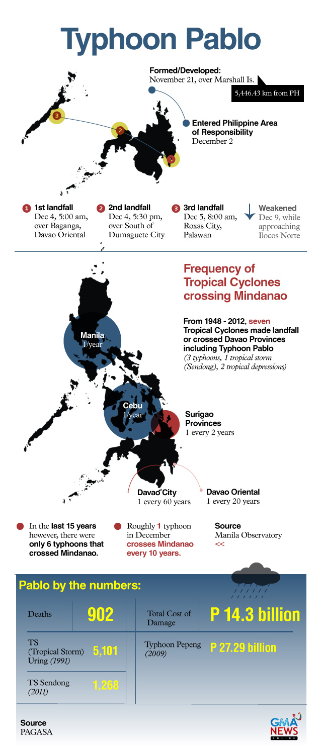
Pablo among most destructive, powerful typhoons in PHL history
Last week, Typhoon Pablo hammered large swaths of Mindanao, Visayas and Northern Palawan and left a trail of death and destruction in its wake. And even as Pablo's final toll is still being counted—over 800 people remain missing— PAGASA said that the typhoon has already set four records in terms of strength. 1. Strongest to make landfall in 2012 For 2012, at least, it is the strongest to make landfall in the Philippines at 185 kph. Other cyclones that made landfall in the Philippines this year were Typhoon Helen in August with peak intensity of 120 kph and Typhoon Ofel in October at 155 kph. 2. Strongest since Super Typhoon Juan in 2010 In a presentation, PAGASA Director Dr. Nathaniel Servando said that Pablo is also the strongest typhoon to hit the Philippines since Super Typhoon Juan in 2010. Super Typhoon Juan (Megi) was packing winds of 225 kph before it made landfall in Northern Sierra Madre on Oct. 17, 2010. Public Storm Warning Signal Number 4 was hoisted over Cagayan, Isabela, Kalinga, Mt. Province, and Ifugao. By Oct. 20, Juan had left 11 people dead and 16 injured, with over P1 billion in losses from damaged crops and property. Juan is also included in PAGASA's list of most disastrous tropical cyclones from 1970 to 2010. 3. Strongest typhoon to cross Mindanao since Typhoon Nitang in 1984 PAGASA records show that Typhoon Nitang (Ike), with winds of around 230 kph, ravaged parts of Visayas and Mindanao, including Siargao Island, Cebu, Negros, and Surigao del Norte from Aug. 31 to Sept. 4, 1984, leaving 1,492 dead, with an estimated damage to crops and property of P4.1 billion. 4. Strongest typhoon crossing Davao provinces since Typhoon Titang in 1970 The National Disaster Coordinating Council at the time recorded Typhoon Titang (Kate) to be packing sustained winds of around 240 kph. Hitting mainly Western Visayas and parts of Mindanao, Titang left 631 casualties, 76 people injured, and around P305 million in damage to crops and property.


