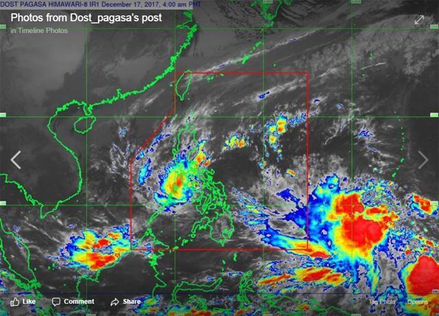
‘Vinta’ may take Urduja’s path —PAGASA forecaster
The cyclone entering the Philippine Area of Responsibility may follow Tropical Storm Urduja's track, a PAGASA weather forecaster said Sunday morning.
PAGASA's Aldzcar Aurelio told Super Radyo dzBB that the cyclone is forecast to enter the PAR by Tuesday or Wednesday, and may take Urduja's westward path.
"Posible pong tatahakin ng paparating na bagyo ang daan ni Urduja. Usually sa ganitong mga buwan, Visayas at Mindanao ang dinadaanan ng mga bagyo... dahil sa malamig na hanging Amihan," Aurelio said.

The cold winds from the Northeast Monsoon (Amihan) during the "Ber" months push the cyclones in this time of the year down to the Visayas-Mindanao areas.
Aurelio said that Amihan will have an effect on the incoming cyclone, which will be code named "Vinta" once it enters the PAR.
Meanwhile, Urduja lingers over Calbayog in Northern Samar as of 7 a.m. Sunday.
Given its speed and direction, it is projected to be:
- 60 kms north-northeast of Cuyo, Palawan by Monday morning,
- 120 kms north-northwest of Puerto Princesa City, Palawan by Tuesday morning,
- 360 kms west of Puerto Princesa City, Palawan by Wednesday morning, and
- 675 kms west of Puerto Princesa City, Palawan and outside the Philippine Area of Responsibility by Thursday morning.
—LBG, GMA News


