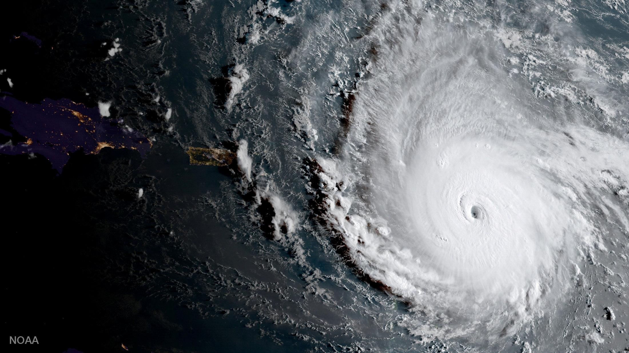
Hurricane Irma shatters multiple records

PARIS, France - Hurricane Irma, rampaging across the Caribbean towards the Bahamas and south Florida, is smashing not only homes and hotels but weather records as well.
The Category Five super-storm has generated winds averaging 295 kilometers per hour (183 miles per hour) for more than 33 hours, longer than any cyclone of comparable power ever recorded, France's weather service said on Thursday.
"Such an intensity, for such a long period, has never been observed in the satellite era," which began in the early 1970s, said Etienne Kapikian, a forecaster at Meteo France.
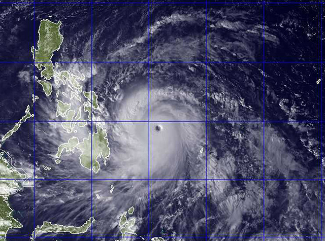
The runner up is Typhoon Haiyan, which left more than 7,000 people dead or missing in the Philippines and packed winds of nearly 300 km/h for 24 hours in 2013.

File photo of NEXSAT satellite image from the US Naval Research Lab of Typhoon Haiyan, which was re-named Typhoon Yolanda when it entered the Philippine Area of Responsibility in November 2013.
Category Five tropical storms, the highest level on the Saffir-Simpson scale, produce sustained winds of more than 252 km/h.
Irma may remain at Category Five for another day or two, by which time it will be at Florida's doorstep, Kapikian told AFP.
"Most scenarios track the hurricane through the Miami region," he added. "When it hits, it will likely be at least a Category Four storm."
Irma set another record by reaching such intensity without having entered the balmy waters of the Caribbean Sea or the Gulf of Mexico, historically the incubators of mega hurricanes.
Tropical storms gather strength from ocean waters above 26 degree Celsius (79 degrees Fahrenheit).
"What is remarkable about Irma -- and this is a first -- is that it reached Category Five before it arrived at the Caribbean," said Patrick Galois another forecaster at Meteo France.
The fact that the violently-swirling mass of clouds and water was able to turbo-charge over the Atlantic -- whose waters are colder than the Caribbean but warmer than a few decades ago -- is consistent with climate change, noted Fabrice Chauvin, a scientist at France's National Centre of Meteorological Research in Toulouse.
- 26 million at risk -
"This becomes more probable in a warming world," he told AFP, while noting there is not enough data to link global warming to any particular storm.
Other climate scientists made the same point, even if connecting the dots remains a challenge.
"Hurricane Irma and Hurricane Harvey fit within the long-term trend toward fewer but increasingly powerful hurricanes," said James Baldini, a hurricane expert at Durham University in England.
They are "a direct result of rising North Atlantic sea surface temperatures under global warming."
Hurricane Harvey devastated the Houston region of Texas in late August, dropping more than 125 centimeters (50 inches) of rain in some areas.
Irma has already "battered" 1.2 million people, the Red Cross said Thursday, warning the storm could upend the lives of as many as 26 million in the coming days. At least five people are reported dead.
The hurricane is the most powerful ever recorded in the Atlantic basin outside of the Caribbean and the Gulf of Mexico, according to the US National Hurricane Center.
It shares the record for the strongest to make landfall anywhere in the Atlantic basin with a Category Five storm packing 295-km/h winds that hit Florida in 1935, Kapikian said.
And if Irma keeps its top-level status through Sunday, it could challenge the 1961 Typhoon Nancy in the northwest Pacific as the longest continuous Category 5 storm on record. — Agence France-Presse


